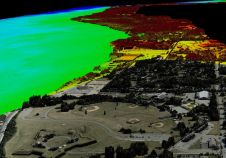
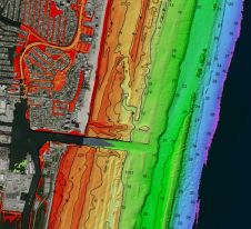
Found 226 results
Sort by

TopoDOT Gains Momentum

Caltrans, West Virginia and Ohio, USA, have recently joined seven other U.S. state transportation departments (DOTs) using TopoDOT for processing Lidar data from tripod, mobile and airborne systems. Other state...

Read more

From paper to pixels in Benin

To provide all Beninese citizens the right to access land, bring economic prosperity and prevent land-related disputes, the Beninese government aims to establish a nationwide digital land administration system. With...

Read more

Think Big for Coastal Mapping

“Think big for coastal mapping” is the foremost advice that Don Ventura of Teledyne Geospatial would impress upon agencies interested in bathymetric Lidar. “It’s a matter of efficiency of scale.”...

Read more