Keeping an Eye on Emerging Technology
Positioning and navigation company Trimble has been on a shopping spree, buying several companies – including remote sensing solutions business Gatewing – in what appears to be part of a...
Positioning and navigation company Trimble has been on a shopping spree, buying several companies – including remote sensing solutions business Gatewing – in what appears to be part of a...

Germany is currently in the midst of a transition from nuclear power to renewable energy. Since geomatics plays a vital role in this huge shift, it is no surprise that...
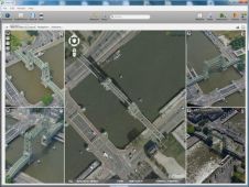
Orbit GeoSpatial Technologies has introduced a brand new member of the Mapping 10.5 portfolio called 'Orbit Obliques', the first official release for full support of Oblique Imagery in the portfolio....

Which factors secure the success of an emergent technology? After years of toil within a university or laboratory, researchers realise that their findings have market potential. Co-operation with a commercial...

Schiebel, FLIR and Transpower have announced the successful demonstration of the Schiebel CAMCOPTER S-100 Unmanned Aerial System with the integrated FLIR Corona 350 sensor being used to inspect high-voltage power...
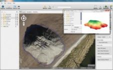
Orbit GeoSpatial Technologies has released its photogrammetric UAS mapping application of Orbit Strabo Photogrammetry 10.5, and the update is immediately available for download. This upgrade adds new features on several...

The 19th edition of Intergeo, held this year in Essen, Germany, once again showcased the newest technology and trends in geomatics. The combined conference and trade show, which featured over...

The Ministry of Defence in The Netherlands has revoked the ban on the taking of aerial photos and video films with effect from 1 June 2013. The reason for lifting...

A group of around 20 MSc students from Delft University of Technology, The Netherlands, spent two days at Intergeo 2013 in Essen, Germany, as part of their course on Sensing...
CompassData, a worldwide provider of high-quality ground control points (GCPs) for GIS, photogrammetric and remote sensing applications, has announced that its archive of commercial GCPs now exceeds 26,000 points. The...
This site uses cookies. By continuing to use this website, you agree to our Cookies Policy. Agree