Tomorrow’s Global Geospatial Needs
The International Society for Photogrammetry and Remote Sensing (ISPRS) is one of the leading organisations within the geomatics sector and has a long-standing partnership with GIM International. We spoke to...

The International Society for Photogrammetry and Remote Sensing (ISPRS) is one of the leading organisations within the geomatics sector and has a long-standing partnership with GIM International. We spoke to...

The year ahead offers better opportunities than we’ve had since the financial crash of 2008. But it does need members to engage in events and in their journal. Tell us...
Collecting and processing point clouds has been trending topic in the geospatial sector over the past few years. This article focuses on point cloud processing software aimed at creating DEMs...

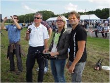
The Unmanned Aerial Vehicles in Geomatics (UAV-g) conference 2013 is taking place this week in Rostock, Germany. UAS professionals from all over the world will be gathering in the city,...
Activities carried out by Commission 4 are highly interdisciplinary, and many of these activities are co-ordinated in close co-operation with IAG sister organisations, US Institute of Navigation (ION), International Society...
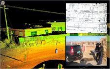
Heavy rainfall in late May and early June 2013 caused the Rivers Elbe, Vltava and Kamenice to burst their banks in the Czech Republic. Among other areas, the Troja area...
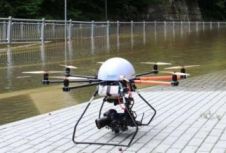
Skeye, The Netherlands, has secured a contract from the Dutch oil company NAM (Nederlandse Aardolie Maatschappij), a joint venture between Shell (50%) and ExxonMobil (50%). The contract comprises the mapping...
OxTS will show its new GPS-aided inertial navigation system xNAV500 at this year's AUVSI Unmanned Systems Conference in Orlando, USA, from 13-15 May 2014. The new xNAV500 represents an addition...

The American Society for Photogrammetry and Remote Sensing (ASPRS) held its 2014 annual conference for the first time with the co-located Joint Agency Commercial Imagery Evaluation (JACIE) Workshop. The event...
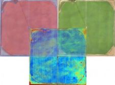
Tetracam and Pix4D have jointly announced a global alliance that combines the technological strengths of both companies to improve farming by means of airborne remote sensing. The alliance is only...
This site uses cookies. By continuing to use this website, you agree to our Cookies Policy. Agree