Experiences in UAS Photogrammetry
UAS mapping is widely accepted as a new method for acquiring spatial image data. The main business opportunities clearly lie in projects which are too small to be of interest...
UAS mapping is widely accepted as a new method for acquiring spatial image data. The main business opportunities clearly lie in projects which are too small to be of interest...
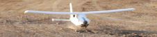
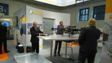
MAVinci will be offering exciting live UAS flight demonstrations next to the Hanover fair area at Intergeo from 9 to 11 October 2012. Visitors to the UAS demonstration can watch...
MAVinci Desktop is a professional software that handles all UAV-related tasks from flight planning to UAV control. MAVinci will be showing new features during Intergeo, to be held from 9...
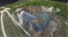
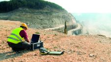
Unmanned airborne systems have great potential for rapidly mapping mountainous areas, to minimize risks to mountaineers and first responders. High mountains are attractive places for outdoor sports. However, sometimes they...
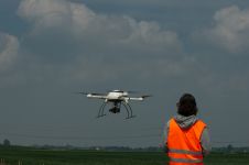
If vegetation comes into direct contact with power lines it can cause service disruption, not to mention fires or even electrocutions. To avoid such undesirable consequences, most energy companies spend...
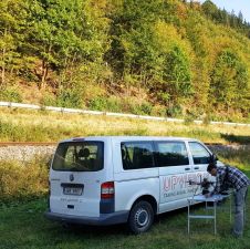
Today’s photogrammetric software is able to create dense and precise digital surface models (DSMs), digital elevation models (DEMs) and orthoimages. But is the accuracy sufficient for highly demanding railway applications?...
Many people dream of making a living out of remotely piloted aircraft systems (RPASs), but so far a lack of clear rules and regulations has stood in the way of...
Nowadays, it’s hard to imagine the geomatics industry without unmanned aerial vehicles (UAVs) – and yet they only arrived on the scene around five years ago. When the very first...
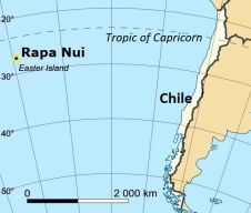
Unmanned aerial systems (UASs) can be easily transported and this beneficial feature is ideal for photogrammetric surveys of remote spaces. Rapa Nui (Easter Island), the most isolated inhabited place on...
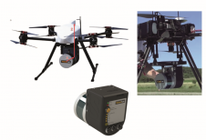
One of the most eye-catching product launches at Intergeo 2014 was RIEGL’s self-developed UAS, equipped with the VUX-1 survey-grade Lidar sensor. The new UAS, called RiCOPTER, marks an important step...
This site uses cookies. By continuing to use this website, you agree to our Cookies Policy. Agree