Found 489 results
Sort by

New Showcase for UAS Exhibitors during Intergeo

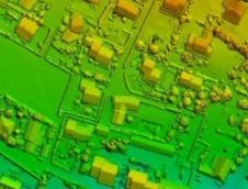
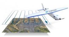
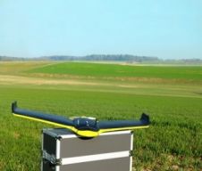
Intergeo's integrated ‘interaerial SOLUTIONS’ platform is a response to the rapid development in data acquisition, analysis and applications for unmanned flight systems. The recently agreed partnership with the German-speaking Unmanned...

Read more

UAS Captures Near-infra-red Mapping Data

DroneMetrex has announced that near-infra-red (NIR) mapping data has been captured with the TopoDrone-100. The radiometric quality has been achieved because DroneMetrex specialists performed the necessary camera modifications and have...

Read more

Regulations UAS /UAV in United States

The U.S. Department of Transportation’s Federal Aviation Administration (FAA) has proposed a framework of regulations that would allow routine use of certain small unmanned aircraft systems (UASs) in today’s American...

Read more

The Rapid Rise of UAS in Geomatics

Peter Cosyn co-founded Gatewing in 2012. The start-up company’s X100 fixed-wing UAS soon attracted interest from Trimble, which acquired the company in 2012. In this interview with GIM International, Peter...

Read more