Pioneering Bespoke Small-scale Aerial Mapping
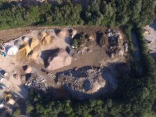
Since 2009 Blom Germany have been working with SmartPlanes to develop a cost-effective light-weight UAV solution for the European market. With more than a hundred trials and now some ten...

Since 2009 Blom Germany have been working with SmartPlanes to develop a cost-effective light-weight UAV solution for the European market. With more than a hundred trials and now some ten...
Trimble has, at Photogrammetric Week, presented its 80 megapixel Trimble Aerial Camera (TAC 80MP), extending the range of applications for today's medium-format aerial cameras. With advanced features such as Trimble's...
The idea for designing an Unmanned Aerial System (UAS) originated from a doctoral dissertation in aerodynamics by the company’s CTO, Peter Cosyn. Maarten Van Speybroeck, operations director, was involved with...
University of California San Diego (UCSD, USA) research fellow and GeoEye Foundation grantee Albert Yu-Min Lin, PhD, has been featured on National Geographic Channel's broadcast, "Forbidden Tomb of Genghis Khan"....
One of the most complex and time-consuming tasks in the photogrammetric workflow is the extraction of corresponding points in two or more overlapping images. This is the first stage of...

The first day of Intergeo on 27th September 2011 has shown many new developments in the world of geomatics. UAVs obviously is one of the hot topics this year, compared...
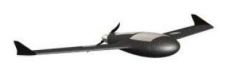
Couderé Geomatic Engineering, Belgium, and Gatewing have entered into an agreement which allows Couderé to market and support Gatewing's X100 unmanned aerial vehicle in Belgium, The Netherlands, Luxembourg, Germany, Switzerland...
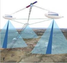
Unmanned Aerial Vehicles (UAVs) flying for months or years above the Jet Stream will form a new communication and sensing infrastructure. National security payloads will emphasise sensors like cameras or...
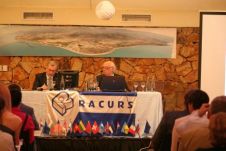
Racurs organised its 11th conference in Tossa de Mar, Spain. The conference was opened by the mayor of Tossa de Mar, Mrs. Gisela Saladich, Doctor of technical sciences Victor P....
Pythagoras BV has been developing software solutions for the geospatial industry for more than 30 years. We strive to deliver CAD & GIS solutions for all your mapping projects. Together...
This site uses cookies. By continuing to use this website, you agree to our Cookies Policy. Agree