KOREC Strengthens UAV Position
An agreement with Germany-based hexacopter manufacturer Aibotix improves the position of KOREC, headquartered in the UK, in the UAV sector. The company will be an Aibotix ‘Premier Partner’ and the...
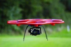
An agreement with Germany-based hexacopter manufacturer Aibotix improves the position of KOREC, headquartered in the UK, in the UAV sector. The company will be an Aibotix ‘Premier Partner’ and the...
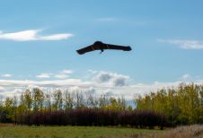
A recent forestry-based case study demonstrates the value of remote sensing techniques such as UAV-Lidar for identifying diseased or damaged trees and overgrown vegetation close to powerlines to prevent outages...
Unmanned Aerial Vehicles come in different forms (fixed-wing, copter, hybrid) and for many purposes and require different skills. Re-usable aircraft flown without onboard human crew have been in existence since 1916, the bulk of applications concerning reconnaissance and other military missions too shady, dirty or dodgy for human...
Van Oord is using Marlyn Cobalt survey drones to ensure design conformance and increase safety at the Port of Rotterdam, the largest container port in Europe. The Dutch port is...
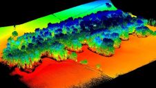
A new case study from Routescene demonstrates the value of UAV-Lidar point cloud data for operational forest management. Traditionally, gathering metrics and information for forest management has been undertaken using...
While it is positive news for our industry that the use of unmanned aerial vehicles (UAVs or ‘drones’) is continuing to increase, the rise has brought with it a key...
In a new partnership with YellowScan, FIXAR's flagship UAV model, the FIXAR 007, will be upgraded with a YellowScan Lidar system. YellowScan is one of the leading designers of next-generation...
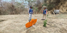
A local geospatial company called Omphika is using the WingtraOne UAV to improve land management in Mexico. Only about 300 of the nation's 2,500 counties currently have proper cadastral studies...

Harxon demonstrated its dedication to innovation at Intergeo 2023 by introducing two products designed to advance high-accuracy positioning within the geospatial industry: the Survey GNSS Antenna (HX-CSX600A) and the Helix...
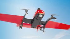
Parrot has unveiled ANAFI Ai: a drone that sets new standards and capabilities for professionals. With a somewhat different appearance from most drones, it has insectile features. ANAFI Ai uses...
This site uses cookies. By continuing to use this website, you agree to our Cookies Policy. Agree