Ca Dept Water Resources
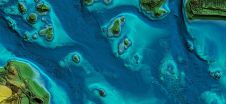
In this article, we examine the evolving landscape of bathymetry with insights from Anders Ekelund, vice president of airborne bathymetric Lidar at Hexagon Geosystems. Beyond mapping seagrass, Ekelund unveils Lidar’s...
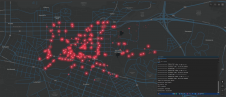
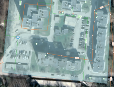
How can city digital twins support the attainment of SDG11? They can be used to manage infrastructures (e.g. roads, transportation and public services, smarter energy grids and water networks), support...
Real-time monitoring can reduce long-term losses caused by holes across a network of water pipes. At 6 bar pressure, a pipe with a 6mm hole will leak 1.8 cubic metres...
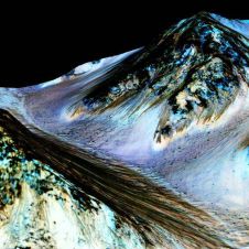
To tie in with NASA’s recent announcement about the discovery of liquid water on Mars, Esri has put together an interactive story map showing the craters and canyons on Mars that...
This site uses cookies. By continuing to use this website, you agree to our Cookies Policy. Agree