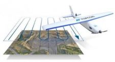
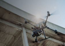
Found 6887 results
Sort by

GerMAP Launches New Aerial Mapping UAV

G170-V, a vertical take-off and landing (VTOL) fixed-wing unmanned aerial vehicle (UAV), is the latest UAV German-based GerMAP has added to the remote sensing and aerial mapping market. G170-V ideally...

Read more

New Unmanned Aerial Photogrammetric Mapping Solution

Drone manufacturer ScientificAerospace together with mapping company DroneMetrex from Adelaide, Australia, has developed a photogrammetric mapping solution that offers new possibilities for the geospatial industry. Building on the advantages of ScientificAerospace’s experience...

Read more