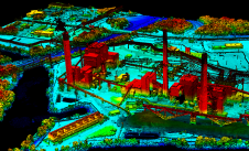
University of Architecture, civil Eng. and Geodesy

Hi-tech 3D modelling software from Pointools is being employed by University College of London (UCL) to create 3D computer visualisations of environmental installations. Researchers at the acclaimed Bartlett School of...
ESRI (CA, USA) has released ArcGIS 9.2 software, a developer technology designed to support Service-Oriented Architecture (SOA) systems. SOA focuses on an approach that supports heterogeneous, loosely coupled services. ArcGIS...

The revolutionary use of active GNSS control points and cutting-edge geomatics equipment is setting new standards for accuracy in the construction of high-rise architecture, as demonstrated by this skyscraper project...

Both vertical and oblique aerial images have their own advantages, making them valuable in different reality mapping applications. So how can you choose between the two? This comparison will help...

In the rapidly evolving landscape of geospatial technology, the annual Trimble Dimensions gathering is a dependable beacon for the surveying and mapping fields, providing a panoramic view of the current...

RIEGL, the Austria-based laser measurement systems company, is part of the 'Gotthard Landscape: The Unexpected View' exhibition at the Venice Architecture Biennale 2014. Two schools of architecture, the Department of...
Woolpert has forged a strategic alliance with Allvision with the goal of enhancing geospatial artificial intelligence capabilities and applications. This partnership seamlessly integrates Pittsburgh-based geospatial analytics and asset management company...
The Open Geospatial Consortium, Inc. (OGC) (MA, USA) has issued a Call for Participation (CFP) in the "Architecture Implementation Pilot," which is a coordinated interoperability initiative of GEOSS, FedEO and...
This site uses cookies. By continuing to use this website, you agree to our Cookies Policy. Agree