Ecopia and Airbus to Provide Digital Maps on a Global Scale
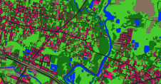
Ecopia AI has entered into a partnership with Airbus to produce next-generation digital maps on a global scale – including land use/land cover, roads and building footprint data. This digital...