UK is a Leader in Heritage Mapping
The mapping of historical cultural features, which we will call heritage mapping, is mainly based on photogrammetric methods. Mapping for this purpose has been going on for many years using...
The mapping of historical cultural features, which we will call heritage mapping, is mainly based on photogrammetric methods. Mapping for this purpose has been going on for many years using...
Airbus Defence and Space and Orbital Insight have expanded upon their partnership agreement to create Earth Monitor, a powerful change analysis and insights service which provides situation awareness over archived or newly...

Slingshot Aerospace, an advanced analytics company, has announced US$5 million in seed funding. The round was led by ATX Venture Partners with participation from new investor Revolution’s Rise of the Rest Seed Fund –...
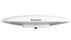
Hemisphere GNSS have announced a single-frequency, multi-GNSS Vector V200 smart antenna with integrated Atlas L-band designed for general marine applications and markets. Powered by Hemisphere's Crescent Vector technology, the V200...
Maxar Technologies, a global technology innovator powering the new space economy, has announced an agreement to integrate its NaturalVue 2.0 image mosaic and National Urban Change Indicator (NUCI) commercial products...
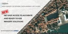
PlanetObserver, provider of value-added geospatial data for civil and military solutions, has announced a partnership with Airbus Defence and Space, a aeronautics, space and related services company, to distribute their...
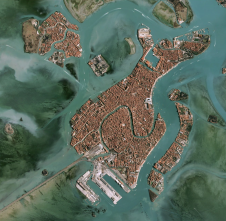
PlanetObserver, provider of value-added geospatial data for civil and military solutions, has announced a new partnership with Airbus Defence and Space, a global leader in aeronautics, space and related services,...

The sun is rising, and spring is very much in the air. The six nations rugby is over (I’ll hold back on any commentary) and thoughts are turning towards the...
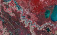
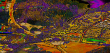
Airbus Defence and Space is now offering new capabilities for wide area monitoring through the DMC Constellation, bringing increased resolution (12 to 24m) and extra spectral bands, including Red-Edge, Blue,...
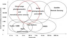
Which technologies and processes are building the capability for high-density 3D data? Point clouds can be captured by an ever-increasing number of means to understand the surrounding reality and detect critical...
This site uses cookies. By continuing to use this website, you agree to our Cookies Policy. Agree