Open Maps For Europe Releases First Datasets
Users can now access the first free-to-use maps via the Open Maps For Europe online gateway. Four open datasets created using official national map, geospatial and land information from members...
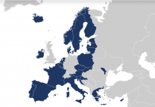
Users can now access the first free-to-use maps via the Open Maps For Europe online gateway. Four open datasets created using official national map, geospatial and land information from members...

Katarína Pukanská is an associate professor at the Institute of Geodesy, Cartography and GIS, Technical University of Košice, Slovakia. Her research interests cover laser scanning and digital photogrammetry in creating...
Karol Bartoš is an assistant professor at the Institute of Geodesy, Cartography and GIS, Technical University of Košice, Slovakia. His research fields are digital photogrammetry technologies, terrestrial laser scanning and...
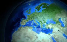
User requirements for authoritative geospatial data and support for policymakers were at the heart of discussions at EuroGeographics 2021 General Assembly. More than 100 leaders and senior representatives from 55 members...
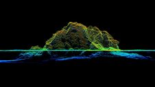
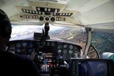
RIEGL tested the performance of its topobathymetric airborne laser scanning system in a transition zone context along the French Mediterranean coast. Initially planned as a UAV survey, tests were conducted...
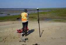
This article presents a participative geomatics project with the goal of increasing southern Québec’s coastal communities’ ability to map and monitor changes in their coastal environment. Capacity-building and empowerment using...
More than 40 companies have joined EAASI since the European aerial mapping industry created the not-for-profit umbrella organization aimed at fostering joint interests less than two years ago. In this...
Prof Jean A. Doumit is a full-time professor of geography and teaches geospatial science subjects in the Faculty of Letters and Human Sciences at the Lebanese University. His research interests...
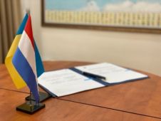
Kadaster (The Netherlands’ Cadastre, Land Registry and Mapping Agency) and StateGeoCadastre Ukraine have signed an MoU on institutional cooperation on National Spatial Data Infrastructure (NSDI). The Memorandum of Understanding (MoU)...
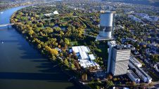
Delegates at the first online-only UN-GGIM session approved the establishment of a new Global Geodetic Centre of Excellence in Bonn, Germany. This new centre will coordinate global alignment and cooperation...
This site uses cookies. By continuing to use this website, you agree to our Cookies Policy. Agree