Point-cloud Preservation Plans
The first step in the preservation of monuments and historic buildings is to completely survey and map the target; this is followed by digitised documentation for future research, reference or...

The first step in the preservation of monuments and historic buildings is to completely survey and map the target; this is followed by digitised documentation for future research, reference or...

Leica Geosystems announces the exclusive distribution of RealityLINx Model 5.4 - powered by Leica point cloud Engine (pcE) technology. RealityLINx Model 5.4 speeds and simplifies the processing of as-built laser...
Leica CloudWorx-VR for 3ds Max, 3ds Max design, and Maya are plug-ins providing a convenient way for professionals to efficiently create more photorealistic and compelling models, renderings, and animations based...
ESRI customers have the option to purchase a cloud-based subscription to ArcGIS Server, ESRI's server-based geographic information system (GIS) software. The annual subscription bundles a preconfigured ArcGIS Server instance on...
Leica Geosystems announces major releases of its flagship point cloud software applications: Cyclone 6.0; CloudWorx 4.0; and TruView 2.0. All applications now include intuitive, panoramic viewing of point clouds plus...

3D Target has continued to make significant advancements since launching its inaugural Scanfly model at Intergeo in 2016, at a time when Lidar technology in the UAV industry was still...

From the skies to the ground, aerial surveying and mapping professionals play a crucial role in capturing, processing, analysing and publishing geospatial data. This article explores the diverse career opportunities...
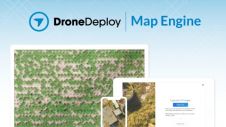
DroneDeploy, a drone software platform with the largest drone data repository in the world, has announced the release of Map Engine - the industry’s first machine learning-driven photogrammetry software. The...
This site uses cookies. By continuing to use this website, you agree to our Cookies Policy. Agree