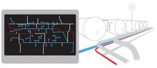
Geospatial, IoT and the Digital Twin
The IoT phenomenon, although still in its infancy, has revolutionised almost every sector in today's world. Among the many buzzwords associated with the field is one known as the 'Digital...
The IoT phenomenon, although still in its infancy, has revolutionised almost every sector in today's world. Among the many buzzwords associated with the field is one known as the 'Digital...

There are indications that today’s technological advances are putting a fully operational multipurpose cadastre within reach, following decades of a global vision and small-scale progress towards a comprehensive map-centric land...

Intermap has won a US$20 million contract to map the Indonesian island of Sulawesi this year. The contract is the first phase of the Indonesian national topographic basemap programme to...

NavVis is partnering up with AVEVA to provide users with the technology to access reliable as-built 3D point cloud data and panoramic images. NavVis is known for its advanced reality capture,...
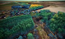
Denmark's Energinet has awarded Fugro a 5-year framework agreement to capture aerial Lidar and imagery data of the 3,000-line km electricity transmission network. The acquired geospatial data will be processed...
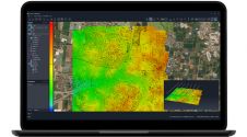
SimActive has unveiled the enhancement of Correlator3D for improved cloud environment productivity. With Correlator3D’s distributed processing capabilities, clients can seamlessly scale their processing in line with operational needs. The challenges...

Hexagon has joined forces with NVIDIA in a collaborative effort to advance industrial digital twin solutions that combine reality capture, manufacturing twins, AI, simulation and visualization. The goal is to...

4Indoor has used a wearable NavVis VLX mobile mapping system to create a high-quality 1.2GB point cloud of the medieval gateway called Koppelpoort in the Dutch city of Amersfoort. 4Indoor,...

Genesys International intends to make a digital twin of the whole of urban India. The launch programme was inaugurated by Amitabh Kant, chief executive officer of the National Institution for...

The London Borough of Harrow has added high-definition street-level imagery and Lidar data to its Esri UK corporate GIS system, giving staff access to a highly accurate digital twin of...
This site uses cookies. By continuing to use this website, you agree to our Cookies Policy. Agree