FIG Working Week 2016: Recovery from Disaster
FIG is inviting surveying professionals to participate in the upcoming FIG Work Week, to be held in Christchurch, New Zealand, from 2-6 May 2016. The FIG Working Week is an...

FIG is inviting surveying professionals to participate in the upcoming FIG Work Week, to be held in Christchurch, New Zealand, from 2-6 May 2016. The FIG Working Week is an...
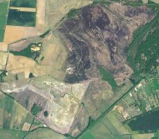
High-resolution aerial photography is providing a map of hard-to-access land to help the UK’s Norfolk Wildlife Trust (NWT) to plan, manage and report on a range of groundbreaking habitat restoration...
The Open Geospatial Consortium (OGC) and sponsors, U.S. Geological Survey (USGS) and Natural Resources Canada (NRCan), in collaboration with the Arctic Spatial Data Infrastructure Participants, have announced a request for...
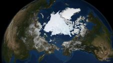
The Open Geospatial Consortium has published the results from the Arctic Spatial Data Pilot (Arctic SDP). The results, including reports, demonstration videos, and interviews, are available at the consortium’s website....
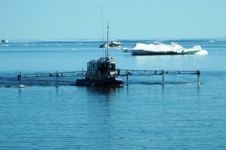
Supergeo’s mobile GIS-app SuperSurv 10 has been selected by the government agency that is in charge of protecting marine and coastal resources in Thailand for spatial data collection. The core...
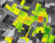
There is a strong requirement for near real-time monitoring forests and crops in order to tackle the present challenges within agriculture and forestry. VHR satellite imagery provides a solution, and...
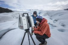
Technological advancements have brought increasingly compact instruments, enabling more rapid data acquisition and powerful processing abilities even in extreme field environments like glaciers, according to Tommaso Santagata, surveyor and speleologist from VIGEA – Virtual Geographic Agency and part of the Patagonia team. “Look deep into nature, and then you will understand everything better,” Albert Einstein is quoted as saying. And indeed, looking deep into glaciers can help us understand climate change. But...
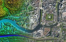
Under a new partnership, Bluesky International will provide its accurate, high-resolution aerial imagery of Great Britain and the Republic of Ireland, alongside other geospatial datasets, to UP42, which is a...
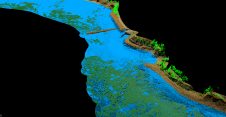
As part of a Catalan government project to improve the management of its marine environment, ICGC cooperated with Field to use airborne Lidar bathymetry (ALB) to survey the Catalan coastal...

In the ever-evolving landscape of climate change, geospatial science emerges as a key player in navigating the complexities of our transforming world. The European Association of Aerial Surveying Industries (EAASI)...
This site uses cookies. By continuing to use this website, you agree to our Cookies Policy. Agree