New UN organization to highlight the value of geodesy
The brand-new United Nations Global Geodetic Centre of Excellence (UN-GGCE) is now operational at the United Nations campus in Bonn, Germany. Nicholas Brown, head of office of the UN-GGCE, is...

The brand-new United Nations Global Geodetic Centre of Excellence (UN-GGCE) is now operational at the United Nations campus in Bonn, Germany. Nicholas Brown, head of office of the UN-GGCE, is...
EuroGeographics is drawing attention to the indispensable role of official national geospatial data in enhancing Copernicus Services, particularly within land monitoring and emergency management. This highlights a reinforced partnership between...
Urs Hugentobler is a professor of Satellite Geodesy and heads the Satellite Geodesy Research Facility of the Technical University of Munich, which operates the Geodetic Observatory Wettzell together with the...
Roland Pail is a professor of Astronomical and Physical Geodesy at the Technical University of Munich. His research activities focus on global and regional modelling of the Earth’s gravity field,...

Detlef Angermann holds a doctorate in Geodesy and heads the Focus Area Reference Systems at the Deutsches Geodätisches Forschungsinstitut (DGFI-TUM) of the Technical University of Munich. His research focuses on...

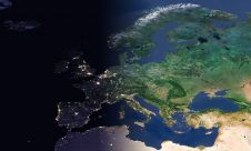
Global reference systems such as the International Terrestrial Reference Frame provide the foundation for determining positions on Earth and in space, as well as for reliably quantifying our planet’s changes...

The EAASI Summit 2023 in Lisbon in November was a resounding success. While the aerial surveying association’s fifth annual gathering highlighted the growing unity within the industry, there was also...

Olga Bjelotomić Oršulić is an assistant professor in the Department for Geodesy and Geomatics at the University North, Croatia. Her interests include physical geodesy, geoid determination, remote sensing, tectonic movement...

Sanja Šamanović is an assistant professor in the Department of Geodesy and Geomatics at the University North in Varaždin. She previously worked in the Faculty of Geodesy at the University...
Jonathan Arthur Quaye-Ballard is a professor and head of the Department of Geomatic Engineering at KNUST, where he has worked for the past 20 years. He also holds a BSc...
This site uses cookies. By continuing to use this website, you agree to our Cookies Policy. Agree