Where do you Start? - INTERGEO 2014
UAVs as platforms or systems were very much to the fore at this year’s INTERGEO. But so was software, reports editor Stephen Booth. In one of the six exhibition halls...

UAVs as platforms or systems were very much to the fore at this year’s INTERGEO. But so was software, reports editor Stephen Booth. In one of the six exhibition halls...
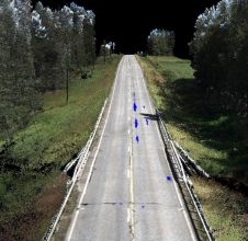
A mobile mapping system (MMS) enables laser data and images of a road and its vicinity to be collected from a van or other moving platform. Here, the author describes...
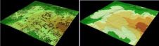
Whether based on Lidar, photogrammetry, radar, sonar or other remote sensors, systems for geodata acquisition create millions or even billions of 3D points. To be useful, the data needs to...

A gold mine in China’s Shandong Province is the country’s first underground mine to use 3D laser scanning. During a one-year project, 20km of major tunnels were scanned and the...

A gold mine in China’s Shandong Province is the country’s first underground mine to use 3D laser scanning. During a one-year project, 20km of major tunnels were scanned and the...
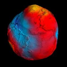
For decades, scientists have disagreed about whether the sea is higher or lower heading north along the east coast of North America. Gravity data from ESA’s GOCE satellite contributed to...
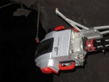
Maptek, the Australian provider of innovative software, hardware and services for the global mining industry, has released a new laser scanner designed specifically for underground applications. The versatile I-Site 8200...
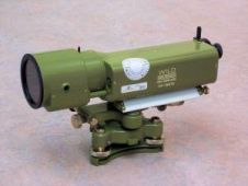
When establishing heights on large geodetic networks, the main problem surveyors encounter are wide bodies of water, such as rivers, that need to be crossed without losing accuracy. Thanks to...

Nowadays, navigation systems have become an integral part of everyday life. But since GNSS-based systems do not work in locations where no GNSS signals can be received, a navigation solution...

At Intergeo 2011, after a period of intensive R&D and refinement activities in Singapore, Horizon will be unveiling an innovation that is expected to quickly gain popularity in the industry....
This site uses cookies. By continuing to use this website, you agree to our Cookies Policy. Agree