Key Global and Technology Drivers Impacting Surveying
As the FIG commission chairs near the halfway point in their terms, they reflect on the global and technological drivers influencing their work. This article describes the breadth of work...
As the FIG commission chairs near the halfway point in their terms, they reflect on the global and technological drivers influencing their work. This article describes the breadth of work...
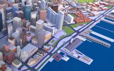
HERE Technologies, a leading location data and technology platform, has released high-fidelity, 3D models of 75 city centres around the world to give software developers the geospatial data needed to...

The beta version of ArcGIS Field Maps, which is available now, combines the functionalities of five existing Esri mobile apps: ArcGIS Collector, ArcGIS Explorer, ArcGIS Tracker, ArcGIS Workforce and ArcGIS...
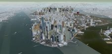
Cesium has announced that its users now have access to Cesium OSM Buildings, a global base layer of more than 350 million 3D buildings. Cesium OSM Buildings expands the suite...
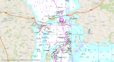
OceanWise, the leading UK-based supplier of Intelligent Marine and Coastal Mapping Data is pleased to announce the release of its Global Raster Chart dataset of the world's oceans: ‘Raster Chart...
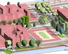
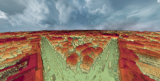
How does 3D city modelling fit within the context of broader developments such as smart cities and digital twins? And which six challenges must be overcome before 3D data as...
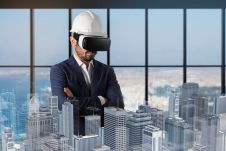
Nearly all engineering, architecture and construction (AEC) professionals focus on finding new ways to increase margins and reduce liability in their businesses. As technology moves so quickly, it can be...
Cesium, a market leader in streaming 3D geospatial technology, has announced it will collaborate with the acclaimed Smithsonian Institution, the world's largest museum, education and research complex, on its Open...
Although it is difficult to entirely close the gap between geospatial and construction data, building information modelling (BIM) could help to narrow it. This article explains how. There is a...
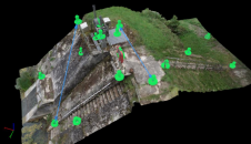
A dense annotated ground-truth Lidar dataset of the city of Dublin is the first of its kind regarding the accuracy, density and diversity of classes. The hierarchical labels offer excellent...
This site uses cookies. By continuing to use this website, you agree to our Cookies Policy. Agree