Farzaneh Dadrass Javan
Farzaneh Dadrass Javan is working in the Earth Observation Science (EOS) department at the University of Twente. She obtained her PhD in Photogrammetry from the University of Tehran in 2012....

Farzaneh Dadrass Javan is working in the Earth Observation Science (EOS) department at the University of Twente. She obtained her PhD in Photogrammetry from the University of Tehran in 2012....
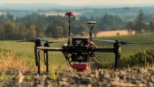
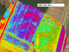
‘Smart agriculture’, i.e. the efficient use of Earth's resources to feed the world, requires accurate and advanced data acquisition, modelling and management. UAVs can play a critical role in this....
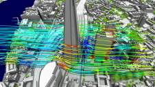
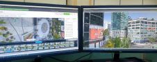
Can digital twins help cities face challenges ranging from sustainability to education, and from infrastructure to healthcare? While digital twin techniques have been applied successfully in manufacturing and construction, cities...
SaeHan Aero Survey has become the first customer in Korea to purchase the IGI UrbanMapper-2P. This nadir and oblique imaging system will be operated together with IGI’s LM-7802S, a high-performing...
Mapping an archaeological site is key to being able to dig with greater precision. Now with the latest digital methods, areas of interest can easily be identified rapidly and non-invasively...
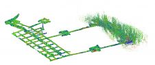
Read how SLAM technology was used to scan a former mine complex in Poland to ensure safety during a project to preserve the site's historical, educational and functional significance. Underground cultural...
Velodyne Lidar has announced a multi-year agreement to provide its Lidar sensors to GreenValley International for handheld, mobile and unmanned aerial vehicle (UAV) 3D mapping solutions, including in GPS-denied environments....
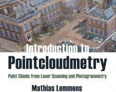
‘Introduction to Pointcloudmetry’ is the title of the new book by Mathias Lemmens, former editor-in-chief of GIM International. Despite the in-depth text, it is a clearly and accessibly presented book...
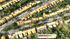
Improved understanding of the amount of solar energy that could be gathered directly from roofs can support the complex task of transitioning existing low-density residential areas to renewable energies. A...
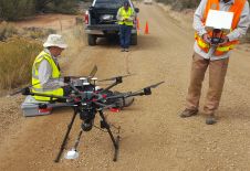
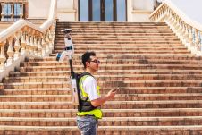
In recent years, the UAV has outgrown its status as a disruptor to become a standard part of the surveyor’s toolkit for capturing the environment. One thing that makes the...
This site uses cookies. By continuing to use this website, you agree to our Cookies Policy. Agree