Racurs
Founded in 1993 in Moscow, Racurs developed rapidly from a small, specialised software developer into a major, international photogrammetric systems supplier and service provider. About 20% of employees at this...
Founded in 1993 in Moscow, Racurs developed rapidly from a small, specialised software developer into a major, international photogrammetric systems supplier and service provider. About 20% of employees at this...
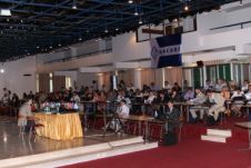
The VIIIth International Scientific and Technical Conference "From imagery to map: digital photogrammetric technologies" was held on the shores of the Adriatic Sea in Porec, Croatia from 15th to 18th...
The organising committee of the 15th International Scientific and Technical Conference “From imagery to map: digital photogrammetriс technologies”, also known as the Racurs Conference, has announced its preliminary programme. The...
Racurs (Russia) has informed that the new version Photomod 4.3 software is available. The software version 4.3 includes the following features: - complete ADS40 support - tested on first "alive"...
Racurs (Russia) has made available version 3.7 of PHOTOMOD. Features introduced in this version include on-the-fly epipolar transformation, QuickBird and Ikonos mono blocks processing, and Spot 5 imagery processing (HRG...

Racurs will be organising its annual conference this year on the island of Hainan, China. The 14th International Scientific and Technical Conference called 'From Imagery to Map: Digital Photogrammetric Technologies'...
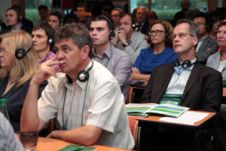
The 13th Racurs Conference entitled 'From Imagery to Map: Digital Photogrammetric Technologies' was held earlier this year in Fontainebleau, France. The list of participants was notable and, with a master-class...

The 13th edition of the annual Racurs Conference will be held from 22-26 September 2013 in Fontainebleau, which is located about 50km southeast of the centre of Paris, France. The...
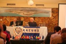
Racurs organised its 11th conference in Tossa de Mar, Spain. The conference was opened by the mayor of Tossa de Mar, Mrs. Gisela Saladich, Doctor of technical sciences Victor P....
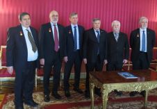
On 5 March 2018, the central board of the Russian Society of Geodesy, Cartography and Land Management chose Racurs as the recipient of the Feodosy Nikolaevich Krasovsky Award. The accolade,...
This site uses cookies. By continuing to use this website, you agree to our Cookies Policy. Agree