Racurs Conference on Remote Sensing
Racurs organised its 11th conference in Tossa de Mar, Spain. The conference was opened by the mayor of Tossa de Mar, Mrs. Gisela Saladich, Doctor of technical sciences Victor P....
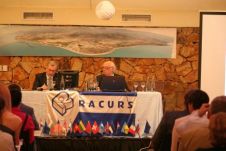
Racurs organised its 11th conference in Tossa de Mar, Spain. The conference was opened by the mayor of Tossa de Mar, Mrs. Gisela Saladich, Doctor of technical sciences Victor P....
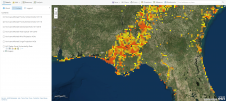
Spatial Energy and Apache Corporation, an internationally operating oil and gas exploration and production company, have announced the launch of a global Health, Safety and Environmental (HSE) monitoring programme using...
GEOSYSTEMS HELLAS, Greece , is collaborating with the Mediterranean Agronomic Institute of Chania (MAICh) and e-GEOS on a three-month project. This project exploits high-resolution imagery in ERDAS products, enabling users...
Please read the contents of this article in the Product Survey section.
DigitalGlobe will act as a platinum sponsor of the IV International conference "Remote sensing - the synergy of high technologies". Annually organized by Sovzond company conference will be held on...

Geo Connect Asia (GCA) is set to return to the Sands Expo and Convention Centre in Singapore on 6 March and 7 March 2024. Since its establishment in 2019, GCA...
During a disastrous event such as a major hurricane, wildfire, catastrophic flooding or a destructive earthquake, first responders must quickly understand the magnitude and the nature of the event and...
IDS GeoRadar, a leading provider of interferometric technology solutions and multi-frequency, multi-channel Ground Penetrating Radar (GPR) worldwide, has launched HYDRA-G, a radar-based technology solution specifically developed to support construction companies...

The Asian Conference on Remote Sensing (ACRS) is an annual event spearheaded by the Asian Association of Remote Sensing (AARS) – Asia’s largest society of remote sensing scientists and professionals....
Merrick & Company, specialised in Lidar, digital orthophotography, hyperspectral imaging and geographic information systems (GIS) data integration, has launched Version 2017 of the Merrick Advanced Remote Sensing (MARS) software suite. The...
This site uses cookies. By continuing to use this website, you agree to our Cookies Policy. Agree