Found 86 results
Sort by

Governing Marine Spaces

The governance of any geographical area, including marine space, is the management of stakeholder relationships with regard to spatial-temporal resource use for many sanctioned economic, social, political and environmental objectives....

Read more

TerraPos Post-processing Software

The Norwegian company Terratec has introduced software capable of accurate positioning based on post-processing of GPS-observations, without the use of reference stations or DGPS services. Typical accuracy for kinematic applications...

Read more

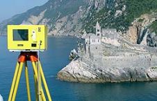
Waterside Mapping in Italy

The combination of 3D-laser scanning and side-scan sonar can be very beneficial for mapping complicated waterside areas; the two systems are complementary. High-resolution surveys were performed over a two-year period...

Read more

Intergeo 2008 Preview

More than five hundred exhibitors from 32 countries are due to put in an appearance at Intergeo 2008, presenting a comprehensive overview of the geo(infor)matics business today. Covering a wide...

Read more

Coastal Approach to Open Architecture

The Coastal and Marine Resources Centre (CMRC) at University College Cork, Ireland, carries out multidisciplinary research primarily aimed at contributing to the scientific understanding of coastal and marine environments and...

Read more

Sokkia European Headquarters

Twenty-five years ago, in 1982, the Japanese Sokkisha Company founded its European headquarters in the Netherlands, first in Weesp and then in Almere, a city erected on land reclaimed from...

Read more

ESRI Vietnam Opens in Hanoi

ESRI has announced the opening of ESRI Vietnam in association with ESRI Thailand. The company hopes to expand the education market in the country and plans to increase GIS training...

Read more

Data Integration for Coastal Surveying

When surveying the coastline, the integration of bathymetric (below sea level) and laser scanning (above sea level) data causes problems due to the different imaging properties. However, by ensuring that...

Read more

Van Oord

Established in 1868 by Govert van Oord, Van Oord is today a conglomerate of Dutch dredging companies, lately best known as constructor of Palm Island, Dubai, the ‘Eighth Wonder of...

Read more

Mapping the Middle East

Owned and operated in the United Arab Emirates, Vision, which was launched at Map Middle East in May 2009, has invested significant resources in expanding its regional aerial-survey and digital-mapping...

Read more