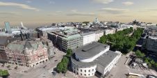
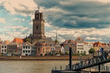
Found 2677 results
Sort by

Smart Societies Prioritise Geoinfo

Putting geoinformation in the mix makes policies more sensible and sustainable, says Ingrid Vanden Berghe. She even devised her own formula: e-gov + g-gov = i-gov (electronic government + geographic...

Read more

Technology for Smart Growth

In the latest SpatialRoundtable.com discussion, ESRI industry solutions manager Dr. Ahmed Abukhater prompts planning leaders to weigh in on the role of technology in creating smart communities. He proposes that...

Read more

Smart Grid Partnership

Intergraph has entered into a partnership with meter data management (MDM) provider eMeter to integrate smart meter data into its Smart Grid Operations Command-and-Control Centre. The integration will provide grid...

Read more

Smart LF Scanner

Colortrac (UK) has launched the Smart LF, a large-format document scanner for professional and corporate users in any size of enterprise. It uses digital imaging technology, Contact Image Sensors (CIS)...

Read more

Peak performance in mobile mapping

It can still be difficult to achieve centimetre-level accuracy in mobile mapping, especially in GNSS-denied or challenging areas such as in deep urban canyons, under foliage or through tunnels. However,...

Read more

Point Clouds and Smart Cities

The ‘smart city’ concept entirely relies on a permanent stream of massive amounts of data acquired by a great variety of sensors distributed throughout the city. Smart use of all...

Read more

Be Smart with Public Land

In every country, the state owns land. Kevin Cahill (‘Who Owns The World’, 2010) argues that Queen Elizabeth II is the largest land owner on Earth, as she possesses the...

Read more