The role of surveyors in building climate resilience
New knowledge and tools are needed if surveyors are to fulfil their critical role along the path to achieving humanity’s global climate goals related to land, water and the marine...

New knowledge and tools are needed if surveyors are to fulfil their critical role along the path to achieving humanity’s global climate goals related to land, water and the marine...

Extremely high speed and highest accuracy make the RIEGL VZ-600i 3D terrestrial laser scanner a most profitable tool for surveyors. Data acquisition – especially of large projects in construction, AEC...
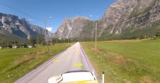
Field and Mosaic have jointly developed an advanced mobile mapping solution for road network management. Thanks to this successful collaboration, road asset managers and owners can now explore and interrogate...
In this exclusive interview, two of the driving forces behind this year's Intergeo talk about the event's evolution and impact, nurturing talent, land surveying, Earth observation and the Blue Economy....
Virtual Surveyor has added drone photogrammetry capabilities to the latest release of its popular Virtual Surveyor smart drone surveying software. The new Terrain Creator app photogrammetrically processes drone photos to...

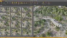
In this interview, John Ristevski, chairman and CEO of CyArk, takes us on the organization’s 20-year journey of digitally preserving cultural heritage sites. Today, the company uses advanced technologies such...
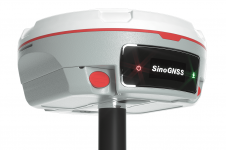
The Mars Pro Laser RTK is the third addition to ComNav’s Universe series of GNSS receivers, following on from the Venus Laser RTK and Mars Laser RTK. According to ComNav...
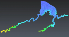
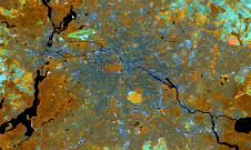
Flash floods pose a significant threat to communities in Fiji and the broader Pacific region. To address this pressing challenge and develop an interactive flood monitoring solution, an aerial Lidar...

It is time to innovate with technology that can be applied ‘right here, right now’. That was the clear message during HxGN LIVE Global 2023. President and CEO Paolo Guglielmini...
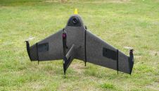
Atmos UAV, a leading innovator in the VTOL mapping drone industry, is excited to announce the integration of the new Sony a6100 Oblique camera into its flagship surveying drone, the...
This site uses cookies. By continuing to use this website, you agree to our Cookies Policy. Agree