Found 2762 results
Sort by

Exploring the potential of videogrammetry

Videogrammetry can be seen as a natural progression from photogrammetry. So how can videogrammetry improve and enhance data collection for surveying professionals? This article explores its intricacies through case studies,...

Read more

Geo Week 2025

Geo Week is the premier event for increased integration between the built environment, advanced airborne/terrestrial technologies, and commercial 3D technologies. It was created as a response to the changing needs of built world...

Read more

Terrestrial Laser Scanning

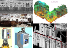
Terrestrial laser scanners are contact-free measuring devices which can collect dense point-clouds of objects. After processing each point is assigned with X, Y, Z coordinates; colour and reflectance value. The...

Read more

Airborne and Terrestrial Laser Scanning

Last month we reported back from the Intergeo trade show that it was all about three abbreviations: Airborne Laser Scanning (ALS), Terrestrial Laser Scanning (TLS) and Mobile Laser Scanning (MLS)....

Read more