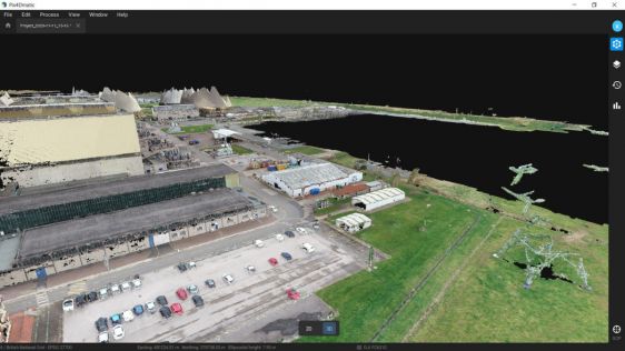
UAS Experiences in Africa: Heat, Dust and Distrustful Locals
When conducting surveys in countries near the equator, environmental conditions can be harsh. Heat, dust and humidity may disrupt sensitive equipment, while distrustful locals may...
 Surveying projects are often undertaken in harsh or remote environments. While this is not always optimal for the land surveyors and other geomatics professionals involved, the projects make great stories in our magazine and on our website.
We’ve picked the finest selection of challenging survey projects from the last couple of years. Keep a close eye on the GIM International website or subscribe to the magazine to stay informed about many more exciting stories in the months and years ahead!
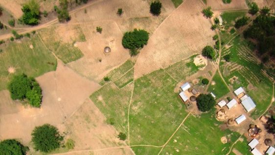
When conducting surveys in countries near the equator, environmental conditions can be harsh. Heat, dust and humidity may disrupt sensitive equipment, while distrustful locals may...
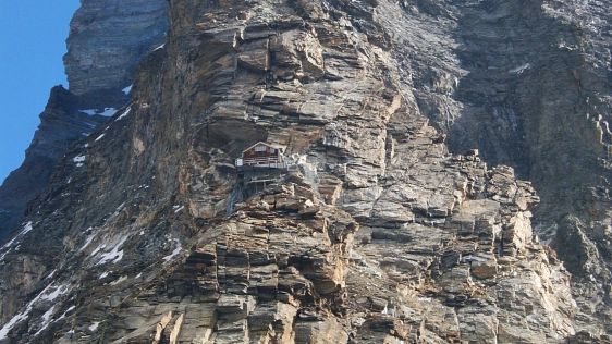
People often describe something hard and immovable as ‘solid as a rock’. But rock does not always live up to its reputation. Depending on its characteristics and local...
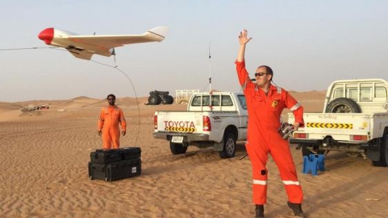
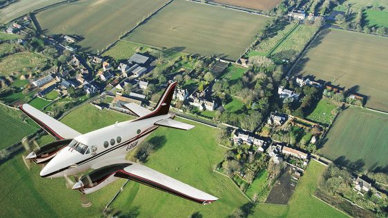
Skeye from The Netherlands and Fugro Maps recently completed an aerial topographic survey using a fixed-wing UAV in the desert south of Abu Dhabi in the United Arab Emirates. Fugro...
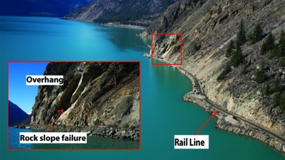
In Western Canada, substantial lengths of the transportation corridors are located within steep mountainous terrain and deeply incised river valleys. This is also the case for the...
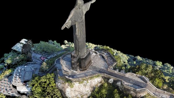
The famous statue of Christ the Redeemer in Rio de Janeiro has been reconstructed in 3D using a UAV. Challenging weather conditions and the sheer size of the monument meant that ca...
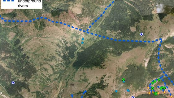
Caves are important in a wide variety of fields, ranging from construction engineering to mineral exploration and archaeology. Despite the scientific importance of caves, geologist...
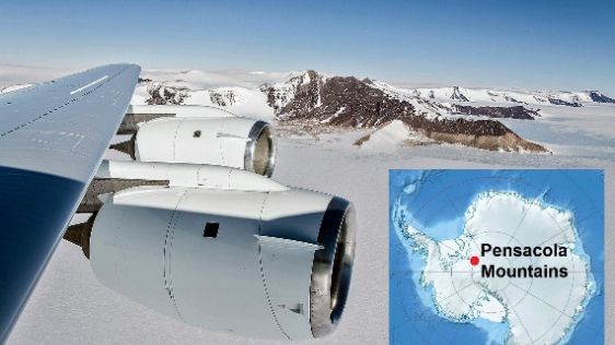
Operation IceBridge completed its 2014 Antarctic field campaign, the sixth in a row, at the end of November. The campaign was aimed at recapturing a part of the Antarctic ice sheet...
The role of aerial surveying in the technological response to challenges such as the global pandemic, climate change and societal issues was discussed at the EAASI Partners Summit...
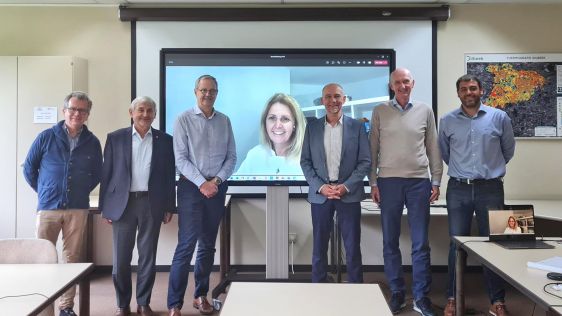
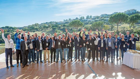
The European Association of Aerial Surveying Industries (EAASI) has extended the mandate of the executive committee to continue to promote the benefits of aerial surveying to the w...
What is the value of high-quality journalism in the geospatial industry? Please complete our survey to help us find out! At GIM International, we are convinced that objective and i...
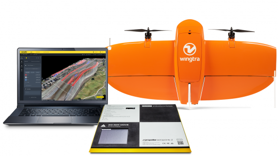
Propeller Aero and Wingtra have joined forces to deliver accurate site data and 3D mapping to construction and earthworks companies across the globe. Propeller Aero is a drone data...
‘To make the European aerial surveying business sustainable’ – that is the vision of EAASI (the European Association of Aerial Surveying Industries). And that is...
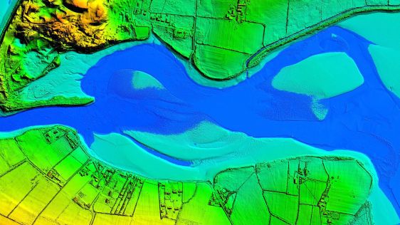
Coal is falling out of favour, resulting in power plant closures. Mapping is a first step in the site redevelopment process, but data collection can be tricky. UAV mapping has prov...

Aerial mapping company Bluesky is to use Lidar to produce a highly detailed 3D map of the National Trust's Wallington Estate in Northumberland, England. The survey will bring to li...
Bluesky International will use aircraft-mounted Lidar sensors to create a highly detailed 3D map of the whole of the Northern Ireland coastline. The Bluesky data will form part of...
This site uses cookies. By continuing to use this website, you agree to our Cookies Policy. Agree