Interacting with Big Geospatial Data
Advances in capturing techniques such as laser scanning and photogrammetry have significantly increased the volume of geospatial datasets. Big geodata has become an important asset...
 Big data is a much discussed subject in the geospatial industry. What to do with all the petabytes of geospatial big data? GIM International selected a series of articles that zoom in on the various issues related to this topic, for example how the geospatial industry can play the key role in underpinning big data.
Advances in capturing techniques such as laser scanning and photogrammetry have significantly increased the volume of geospatial datasets. Big geodata has become an important asset...
The INSPIRE Directive was introduced in 2007 and should reach full implementation in 2020. Today, over halfway through the process, various important milestones have already been a...
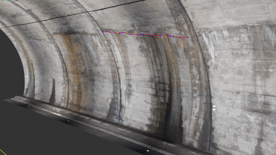
There could be many keywords representing important trends in the capture and use of spatial data in the engineering & construction industry, but 3D, BIM, AR and UAV are defini...
At the start of this year, GIM International conducted a readers’ survey aimed at gaining a clear picture of the current state of the geospatial industry. With more than...
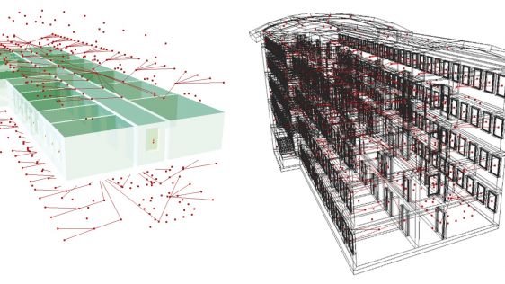
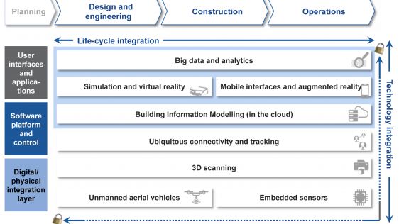
In the construction industry, business relationships are often short term and one-off. There are many unique processes and activities. The resulting complexity and fragmentation ma...

There is growing recognition that the success of the new Sustainable Development Goals (SDGs) will depend on the ability of governments, businesses and civil society to collect and...

10 years from now, a semantic-rich 3D virtual model of our environment will be available and continuously updated by citizens, companies and governments as well as by sensors that...

The idea behind INSPIRE is quite simple: a common framework for all European environmental reference data. The implementation of such a system, however, is less simple. Technology...
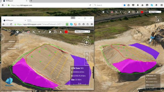
Australian technology company 4DMapper designs, develops and markets a web-based platform for streaming and sharing big geospatial data. Massive amounts of geospatial data can be i...
Follow GIM International on Facebook, LinkedIn, Twitter or sign up for the newsletter! Don't miss the latest developments: join GIM International!
 |  |  |  |
| 29.769 SUBSCRIBERS | 22.513 MEMBERS | 9.484 LIKES | 8.739 FOLLOWERS |
This site uses cookies. By continuing to use this website, you agree to our Cookies Policy. Agree