London's Interactive Digital 3D Model Helps in Solving Urban Dilemmas
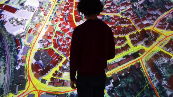
What will London, UK, look like by 2035? Very different to how it looks today – that much is certain. It also seems certain that in the years between 2016 and 2035 we will ne...
This month we’re zooming in on the area of urban planning. Geomatics can be applied in many fields, but urban planning definitely is one of the most eye-catching of them. Supporting the efficient functioning of towns and cities, both now and in the future, and also as a process concerned with the use of land and development of infrastructure, geomatics is widely represented in urban planning. Depending on the local circumstances urban planning can face tough challenges, but this range of articles related to this theme highlights ways of tackling them.

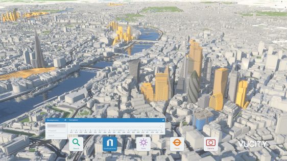
What will London, UK, look like by 2035? Very different to how it looks today – that much is certain. It also seems certain that in the years between 2016 and 2035 we will ne...
Traditional methods of information management are hard to use in the planning process of problematic urban areas such as squatter settlements. GIS provides the capability for dynam...


The municipality of Dubai, UAE, has signed two contracts with Ordnance Survey to harness geospatial data and expertise, accelerate innovation and help develop fundamental services...

GeoSLAM’s hand-held Lidar technology has been utilized to document informal settlements in one of India’s largest cities, Bengaluru, as part of a large-scale urbanizati...
Ecopia AI has entered a CAD8 million dollar funding partnership with Sustainable Development Technology Canada, which will support the creation of high-precision 3D vector maps acr...
As more and more cities are deciding to work with a digital twin, we have selected a number of articles that outline how digital twins are created and how they can add real value....
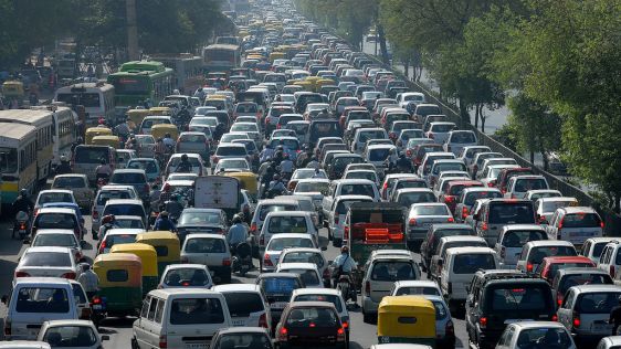
As cities grow, communities' needs change. From traffic patterns and air quality to green space and other comfortable open spaces, urban planners have much to consider when decidin...
Agency9, known for its technology in large scale streaming and 3D visualisation solutions, announces the release of free global 3D terrain and buildings in CityPlanner – its...
Every month we will focus on a specific theme, featuring a selection of articles which have previously been published in GIM International magazine, to present a complete recap of the subject. If you don't want to miss these themed recaps, sign up for the newsletter (sign up here).
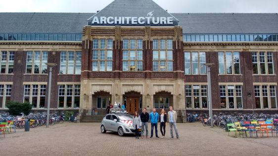
Students in their second - and hence final - year of the Master in Geomatics programme at Delft University of Technology embarked on a ten-week Geomatics Synthesis Project as...
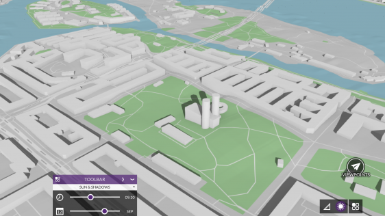
Today’s advanced computer technology enables several players to play the same game at the same time. Can the visualisation technology used in 3D multiplayer games designed fo...
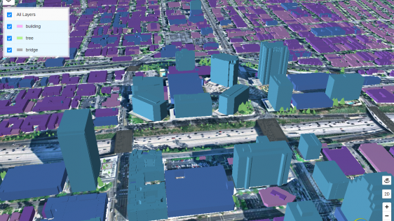
Urban planning has become more complicated due to today’s rate of urbanisation and the rapid expansion of cities. Web-based 3D tools coupled with high-quality 3D city models...
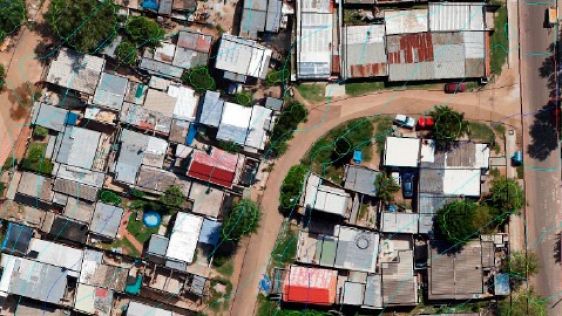
Irregular settlements, also known as 'villas' or 'favelas', present a big challenge in urban planning. When collecting data, whether to determine the existing situation or to plan...
The upsurge in urban population in Indian cities will intensify societal challenges on every conceivable level. To improve the quality of life and attract investment in cities, pro...

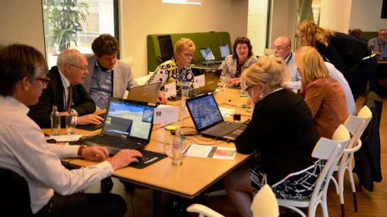
‘Smart Cities’ are liveable, efficient and sustainable cities, where the vertical services are built on an existing, basic infrastructure. Two experienced Hungarian SME...
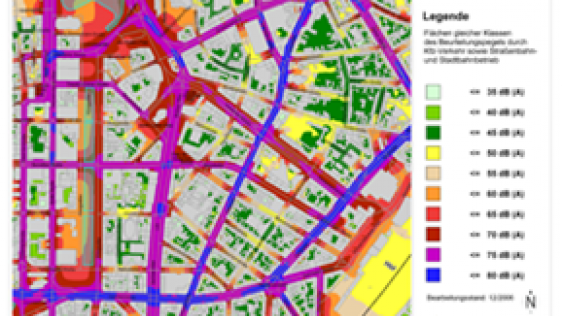
In recent years, Germany's national mapping and cadastre information systems have become increasingly focused on demands for multidimensional applications, e.g. environmental...
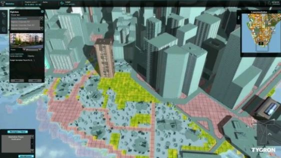
Tygron, a start-up based in Delft, The Netherlands, was once described as ‘the Johan Cruijff of Dutch water management’. This innovative 3D software company applies ser...

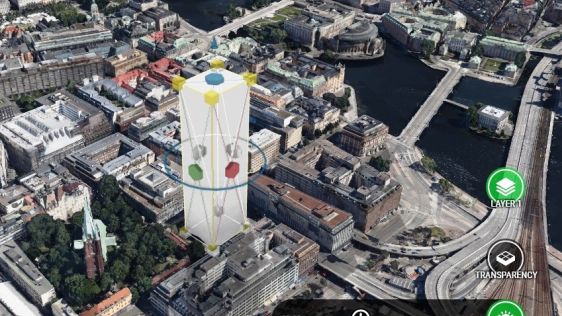
The Swedish 3D industry has repeatedly innovated in public use of 3D and in particular in external city planning applications, for which it has received several international award...
This site uses cookies. By continuing to use this website, you agree to our Cookies Policy. Agree