Woolpert to generate DTM and contours for University of Wyoming
Woolpert has secured a contract with the University of Wyoming to generate a digital terrain model and contours. Leveraging Lidar data previously acquired for the United States Geological Survey (USGS), the firm will develop derivative products. These outputs are intended to support the University of Wyoming and various statewide agencies in addressing diverse mapping, engineering, and planning requirements.
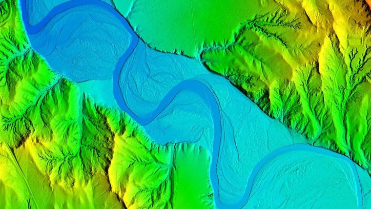
The Wyoming Geographic Information Science Center (WyGISC) at the University of Wyoming (UW) has enlisted Woolpert for the creation of a higher-resolution digital terrain model and contours encompassing the entire land area of Wyoming. This initiative is backed by an allocation from the State of Wyoming Legislature during its 2023 General Session. Woolpert will utilize statewide topographic Lidar data acquired through the 3D Elevation Program (3DEP) under a separate, ongoing, shared capacity contract for the U.S. Geological Survey to develop these products. A digital terrain model, essential for digital surface terrain modelling, will incorporate break lines for large bodies of water, generated using photogrammetric software to meet the newly revised ASPRS Positional Accuracy Standards for Digital Geospatial Data. This framework is integral to Woolpert, according to vice president and chief scientist Qassim Abdullah.
Wyoming Geospatial Hub
Woolpert programme director Brian Stevens explained that topographic contours will primarily be created at 2-foot (60cm) intervals, with exceptions for areas with significant elevation changes, which may be generated at 10-foot intervals. WyGISC, an interdisciplinary research and engagement centre within UW’s School of Computing, facilitates state and local mapping and GIS needs. WyGISC director Jeff Hamerlinck expressed enthusiasm about collaborating with Woolpert to enhance Lidar data utilization statewide, with plans to integrate a new Lidar-specific component into its Wyoming Geospatial Hub, connecting it to UW’s Wyoming Innovation Partnership research data integration platform.
Stevens highlighted the role of these products in advancing WyGISC's research and application capabilities, supporting future statewide mapping initiatives such as the USGS 3D National Hydrography Program (3DHP). Delivery of these products is anticipated by mid-2024.
“The digital terrain model will provide Wyoming with an up-to-date, highly detailed, and more comprehensive understanding of its land,” Stevens said. “From improving water drainage and floodplain mapping to assisting with preliminary engineering and design for agriculture, forestry, transportation, pipelines, water storage, or energy infrastructure projects, the model will serve as an invaluable resource for the Wyoming Geographic Information Science Center and other state agencies as they help move the state of Wyoming forward.”

Value staying current with geomatics?
Stay on the map with our expertly curated newsletters.
We provide educational insights, industry updates, and inspiring stories to help you learn, grow, and reach your full potential in your field. Don't miss out - subscribe today and ensure you're always informed, educated, and inspired.
Choose your newsletter(s)


