
Elevating knowledge: read our in-depth features

Read this interview with Topcon's Ulrich Hermanski for his views on the current status of the surveying profession, the key advances and the future role of surveyors. Since graduating in Geomatics Eng...
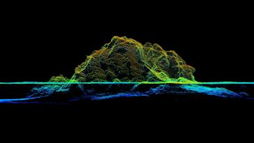
RIEGL tested the performance of its topobathymetric airborne laser scanning system in a transition zone context along the French Mediterranean coast. Initially planned as a UAV survey, tests were cond...
GNSS… it’s almost impossible to run a modern geo-related business without it. But what if a problem should occur? Whether in navigation, surveying or even agriculture, countless activities almost ...
With spoofing attacks on the rise, survey-grade GNSS receivers need to be protected by interference mitigation technology utilizing the latest security techniques to ensure reliable positioning. The s...
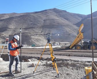
Do you need new acquisition equipment, but you're struggling to assess the alternatives? Mathias Lemmens provides some pointers to support your decision-making. When the need arises for new acquisiti...
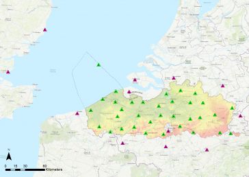
A continuously operating reference station (CORS) provides GNSS data to support very accurate 3D positioning and additional geophysical applications. Flemish Positioning Services (FLEPOS) is the real-...
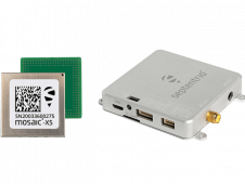
Septentrio’s collaboration with major drone solutions providers is driving new products allowing easier prototyping or integration of its Mosaic GNSS receiver into uncrewed aerial vehicles (UAVs or ...
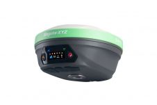
SingularXYZ has presented its latest innovation for geospatial professionals: the X1 Pro GNSS receiver. This new device aims to refine precision in surveying technology with a range of features tailor...
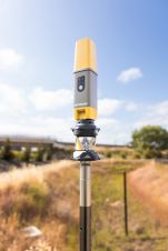
Topcon Positioning Systems has presented the latest addition to its HiPer family of global navigation satellite system (GNSS) receivers. The HiPer CR is a compact and lightweight GNSS receiver designe...
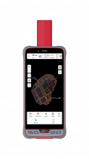
ComNav Technology has introduced its new handheld P6H. This advanced and rugged device is tailor-made for GIS data collection and outdoor operations. Featuring a GNSS high-precision positioning module...
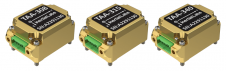
Inertial Labs has unveiled its latest innovation: high-precision three-axis accelerometers (TAA). These compact, self-contained devices mark a significant leap forward in navigation-grade acceleromete...

Harxon demonstrated its dedication to innovation at Intergeo 2023 by introducing two products designed to advance high-accuracy positioning within the geospatial industry: the Survey GNSS Antenna (HX-...
Our weekly newsletter is an easy way to stay updated with our latest articles, news, and magazines. It's the easiest way to stay current with the industry.
Subscribe to our newsletter(s)Positioning, in its essence, represents the meticulous process of accurately determining the spatial location of an object concerning a specific framework or datum. This fundamental concept of positioning plays an indispensable role in the domains of geography and hydrography, persistently guiding the quest to pinpoint the precise locations of the objects and features we seek to measure and understand.
Depending on the specific application at hand, the framework within which positioning occurs can be either of a global or local nature. When thinking on a global scale, the utilization of advanced techniques like Global Navigation Satellite Systems (GNSS) comes into play. In this scenario, the framework for positioning is meticulously defined by geodetic coordinate reference systems, ensuring the utmost accuracy in spatial determinations on a planetary scale.
Conversely, in more localized settings, positioning takes on a distinct character, tailored to the unique demands of specific tasks. For instance, in the realms of construction and engineering, the precision of positioning is paramount, and it's achieved through instruments such as the Total Station, allowing for the highly accurate alignment and placement of structures and infrastructure. Meanwhile, indoor navigation is another intriguing facet of local positioning, where the frameworks are often established within the confines of buildings, where technologies like indoor positioning systems enable precise and efficient navigation.
As we delve deeper into the world of positioning, it becomes evident that this art and science of location determination extends its influence far and wide, offering versatile solutions for diverse applications, all while maintaining an unwavering commitment to spatial accuracy.
This site uses cookies. By continuing to use this website, you agree to our Cookies Policy. Agree