Scientists Calculate Icefield Melting with 2D and 3D Glacier Model
The Juneau Icefield Research Program (JIRP) has calculated that thinning of Alaska’s Taku Glacier has increased from an average rate of half a metre to two metres per year ov...
Read the latest news & articles about GPS (Global Positioning System).

The Juneau Icefield Research Program (JIRP) has calculated that thinning of Alaska’s Taku Glacier has increased from an average rate of half a metre to two metres per year ov...
Racelogic has launched a brand-new indoor positioning system, called VIPS, which is an advanced system for measuring real-time 3D position to an accuracy of ±2cm in areas wh...
A landslide on Clifton Beach, New Zealand, earlier this year injured two Korean tourists when they were washed out to sea. Following this event, the beach was closed while Hastings...

Inpixon, an indoor positioning and data analytics company, has announced it intends to acquire certain GPS products, software, technologies, and intellectual property from a USA ba...

The GPS Week Rollover event will occur on 6 April 2019 at 23:59:42 UTC. This will be the second global event of its kind and will affect all users of Global Positioning System (GPS...
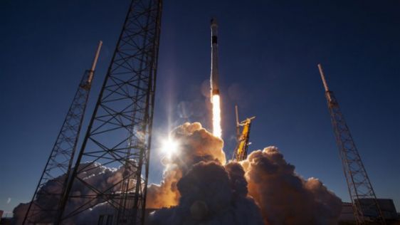
After extensive delays, the first next-generation GPS III Space Vehicle 01 (GPS III SV01) has been successfully launched and reached medium Earth orbit. GPS III SV01 was lofted abo...

Ordnance Survey (OS) has announced the launch of four new off-road OS GPS navigation devices for walking, hiking and off-road cycling. The innovative GPS units are a first for OS,...

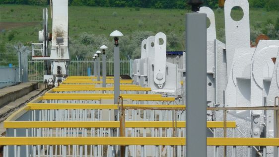
US police officers are trialling a new piece of GPS technology called StarChase to reduce risks associated with pursuits. The StarChase system uses a compressed air launcher mounte...
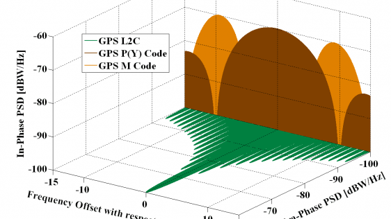
Have you ever wondered about the GPS signal-tracking capabilities ‘L1P, L2E'? One of our readers asked our specialist for an explanation, and this is what he replied. We rece...

Looking back over the past 30 years, it’s hard to believe just how far we’ve come in such a relatively short space of time. Geomatics students in the mid-1980s were exp...
Currently there are four global navigation satellite systems (GNSSs) available: GPS, Glonass, BeiDou and Galileo. The satellites of these systems are used for positioning, and the...
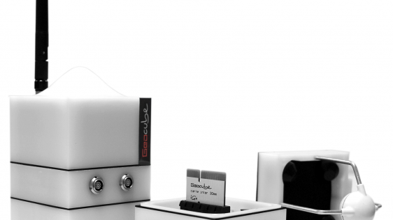
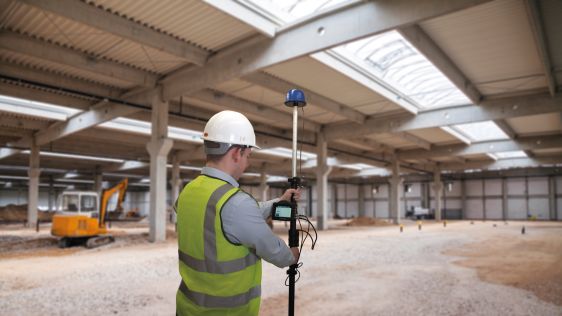
Deformation monitoring of glaciers is of great value to scientists with an interest in climate change. Due to the slow movements of glaciers, a semi-permanent deformation system is...
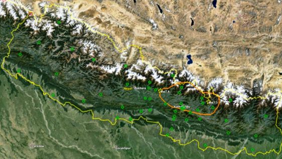
Nepal is prone to earthquakes and throughout the centuries the country’s capital city, Kathmandu, has been regularly struck by earthquakes which appear to have similar epicen...
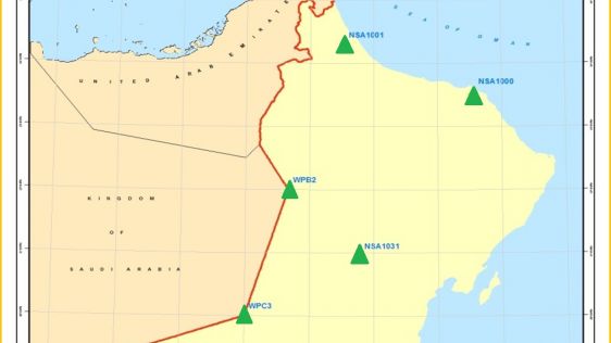
Today GNSS is widely used in Oman. High and homogeneous quality of GNSS positioning requires a geocentric datum attached to the International Terrestrial Reference Frame of which t...

A two-week field trip to Iceland – that was all they were told beforehand. After one year of studying at Delft University of Technology, MSc students headed towards this geodetical...
With so many off-the-shelf GNSS solutions is there still room for innovation? Joël van Cranenbroeck thinks so. One such solution could be based on multiple antennas. But remem...
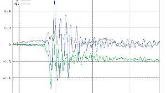
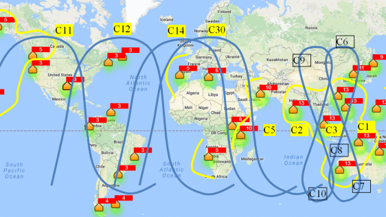
Geomatics is not primarily aimed at investigating the causes and physical phenomena related to earthquake events. It has, however, over recent years established a fundamental role...
I enjoyed all the discussion and speculation at the GSDI 12 Conference in Singapore last October over what ‘SDI 2.0’ would look like. There were also exciting ideas a...
Every month we will focus on a specific theme, featuring a selection of articles which have previously been published in GIM International magazine, to present a complete recap of the subject. If you don't want to miss these themed recaps, sign up for the newsletter (sign up here).
Follow GIM International on Facebook, LinkedIn, Twitter or sign up for the newsletter! Don't miss the latest developments: join GIM International!
 |  |  |  |
| 29.769 SUBSCRIBERS | 22.513 MEMBERS | 9.484 LIKES | 8.739 FOLLOWERS |
This site uses cookies. By continuing to use this website, you agree to our Cookies Policy. Agree