Borough of Poole Makes a Splash with MapThat
Borough of Poole local authority has upgraded its mapping capabilities, both within its intranet and on the website. The new technology has improved information access for Council...
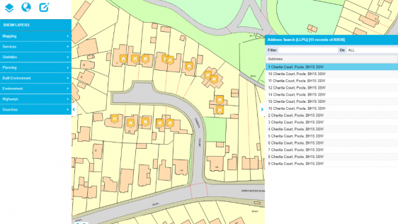
Borough of Poole local authority has upgraded its mapping capabilities, both within its intranet and on the website. The new technology has improved information access for Council...
Traditional methods of information management are hard to use in the planning process of problematic urban areas such as squatter settlements. GIS provides the capability for dynam...
Every month we will focus on a specific theme, featuring a selection of articles which have previously been published in GIM International magazine. GIM brings you a bi-weekly round-up of Focus Stories related to the theme through our newsletter (sign up here).
Petabytes of geographic and spatial data are being captured every day, but how to store, retrieve, manage, display and analyse this mind-dazzling quantity? A Geographic Information System (GIS) is the technology for making better decisions about location and the solution to capture, manipulate and present all types of geospatial data. This month is dedicated to GIS and therefore, we feature a selection of articles which have previously been published in GIM International magazine.

RSK Group has awarded a new enterprise GIS contract to Esri UK to boost the use of geospatial technology across its operations and support ambitious growth plans. This three-year a...

GIS People has unveiled a new e-book resource designed to offer valuable insights into the world of GIS. The e-book is offered entirely free of charge as a means of foste...

Trimble recently released the Trimble Terra Office add-in for Esri ArcGIS Pro. The add-in is a new product in the Terra Office suite of desktop solutions for integrating Trimble Te...

With the theme of ‘Geospatial Intelligence, Elevated by Integration’, the 2023 Geospatial Information Software Technology Conference commenced at the China National Con...

EDF, a French electric utility company, has partnered with Esri UK to implement an enterprise GIS for Hinkley Point C (HPC) nuclear power station, one of the largest and most compl...

Data visualization is inherent to humans and continuously evolves, driven by innovation. How is GIS playing a role in this? The term 'data visualization' has come into popular usag...

The combination of BIM and GIS technology (BIM+GIS) can provide complete and real-time data about facilities and equipment as the basis for more effective monitoring and management...
Over the last three years, building information modelling (BIM) has undergone rapid development around the world. The value chain of design, construction and operation of built ass...

Valued reader, It is with some sadness that I must inform you that this edition will be the final printed edition of GIS Professional. The difficult decision follows careful consid...

Everything is speeding up but I’m going to suggest slowing down. My guess it that the phrase ‘slow learning’ is new to many readers. Slow learning is a vision for...
To improve the situation of the extremely high price level of real estate and to address the issue of adequate housing, the Taiwanese government has established the Real Estate Tra...

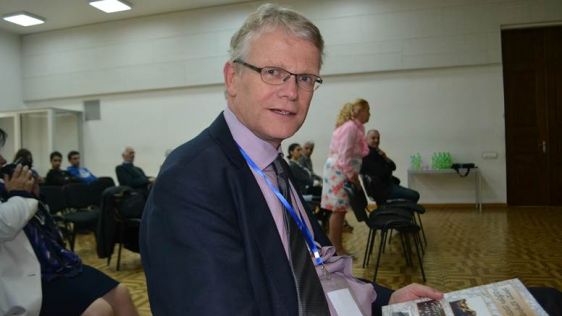
As Google’s geospatial technologist, Ed Parsons is responsible for evangelising Google’s mission to organise the world’s information using geography. GIM Internat...

“Staying private and debt-free gives us a level of freedom to do the right thing that we would never have in a heavily-leveraged company or public company,” Jack Danger...
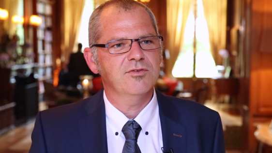
Menno-Jan Kraak is the newly elected president of the International Cartographic Association (ICA). Cartographer Kraak is a professor in Geovisual Analytics and Cartography at the...
Today’s advanced computer technology enables several players to play the same game at the same time. Can the visualisation technology used in 3D multiplayer games designed fo...

The term ‘superhero’, to which the copyright is owned jointly by the two biggest comic-book firms in the United States – Marvel and DC Comics – generally re...

Esri recently exhibited at The Next Web Europe, a conference focused on entrepreneurship, technology and startups in Amsterdam, The Netherlands. But why was Esri involved? Is it lo...
The INSPIRE Directive was introduced in 2007 and should reach full implementation in 2020. Today, over halfway through the process, various important milestones have already been a...
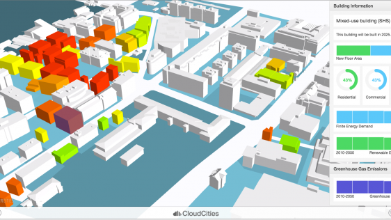
SmarterBetterCities is a software company located in Zurich, Switzerland, which creates CloudCities: a cloud platform for smart city planning and smarter urban management. In line...

Three colleagues and I have been wrestling for two years with how we can best deliver a new version of our GIS textbook. The three previous editions have been successful, having so...
This site uses cookies. By continuing to use this website, you agree to our Cookies Policy. Agree