Singapore’s journey towards a nationwide digital twin
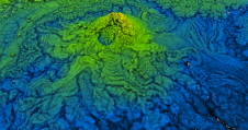
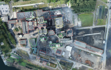
When it comes to utilizing the true potential of digital twin technology, Singapore is miles ahead of most other governments. Even those that have already embraced the concept of the...

When it comes to utilizing the true potential of digital twin technology, Singapore is miles ahead of most other governments. Even those that have already embraced the concept of the...
These inspiring articles all prove the versatility of the brilliant technology that is Lidar. Sensor miniaturization has made Lidar technology easier to integrate, enabling applications such as UAV-based and handheld...

This selection of articles highlights the diversity of Lidar as a flexible tool for surveying and mapping professionals. Thanks to sensor miniaturization, laser technology is available in many different guises...
What is the current state of acceptance of mobile mapping, and what are its most common applications? A worldwide survey commissioned by NavVis, and supported by 'GIM International' plus three other...

Besides the surveying hardware & software and the intricacies of BIM and data exchange, this article explores broader aspects of digitalization in the construction industry. How are they affecting the...

A professor and undergraduate students from James Madison University have geospatially scanned the oldest show cave in the USA, Grand Caverns in Virginia, and digitally mapped the largest room in...
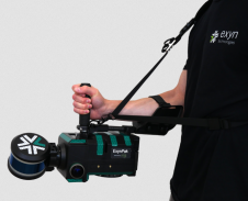
Burgex Mining Consultants has announced newly acquired in-house capabilities to provide high-accuracy mapping of surface and underground mine workings with the addition of the ExynPak from Exyn Technologies to its...
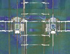
Read about this automated mobile laser scanning system developed for mining. It facilitates fast and precise measurements to produce a 3D model of the mine shaft for further analysis. Mine...
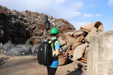
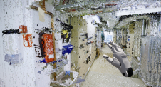
Construction sites and, especially, demolition sites are often challenging environments for surveyors. Nevertheless, effective project management and financial control depend on accurate and timely information about the volumes of materials...
How can the dense point clouds that originate from 3D mapping be turned into useful game engine scenes? This article considers issues including point classification and segmentation, geometric accuracy and...
This site uses cookies. By continuing to use this website, you agree to our Cookies Policy. Agree