Shift to Aerial Photogrammetry
Rollei GmbH was founded in 1920 as Rollei Fototechnic GmbH, in Braunschweig, the centre of today’s Germany. Founders Paul Franke and Reinhold Heidecke wanted to build opto-mechanically-superior cameras, not only...
Rollei GmbH was founded in 1920 as Rollei Fototechnic GmbH, in Braunschweig, the centre of today’s Germany. Founders Paul Franke and Reinhold Heidecke wanted to build opto-mechanically-superior cameras, not only...
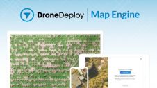
DroneDeploy, a drone software platform with the largest drone data repository in the world, has announced the release of Map Engine - the industry’s first machine learning-driven photogrammetry software. The...

Photogrammetry or Lidar point clouds – both have their advantages, and which one is most suitable depends on the particular application. There is one difference that distinguishes photogrammetry from Lidar,...
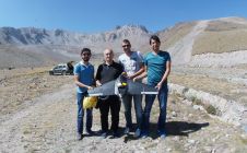
Unmanned airborne systems have great potential for rapidly mapping mountainous areas, to minimize risks to mountaineers and first responders. High mountains are attractive places for outdoor sports. However, sometimes they...
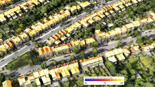
Improved understanding of the amount of solar energy that could be gathered directly from roofs can support the complex task of transitioning existing low-density residential areas to renewable energies. A...
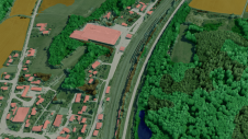
Today’s photogrammetric software is able to create dense and precise digital surface models (DSMs), digital elevation models (DEMs) and orthoimages. But is the accuracy sufficient for highly demanding railway applications?...

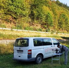
Swiss engineering and geomatics consulting firm Mosini Caviezel SA has been testing terrestrial photogrammetry for indoor mapping as a new method for establishing property plans. The company is evaluating the...

Photogrammetry has made huge progress over the past 15 years, on both hardware and software fronts. Dedicated large-frame cameras enable increasingly high geometric and radiometric precision, capturing overlapping images to...
Innovative methodologies based on artificial intelligence (AI) are lowering the barriers and democratizing the use of 3D digital twins in the geospatial industry. Digital twins are revolutionizing the geospatial industry,...
This site uses cookies. By continuing to use this website, you agree to our Cookies Policy. Agree