Producing Accurate Orthos under the Radar
ERDAS announces Producing Accurate Orthos under the Radar, a free webinar on June 2, 2009 at 11AM (EST). This webinar provides an overview on how to process radar imagery, highlighting...
ERDAS announces Producing Accurate Orthos under the Radar, a free webinar on June 2, 2009 at 11AM (EST). This webinar provides an overview on how to process radar imagery, highlighting...
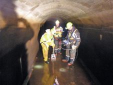
SM Pelorus have completed Ground Penetration Radar (GPR) work valued at GBP10,000 to analyse the buried structure of Thirlmere Aqueduct (Cumbria, UK), the 84 mile-long Victorian water pipe connecting the...
Data from high-resolution radar space sensors is increasingly used for commercial applications. Introduced here are specially designed commercial features and products from the new TerraSAR-X satellite. Also discussed is its...
ERDAS has launched IMAGINE Radar Mapping Suite. In the IMAGINE Radar Mapping Suite 9.3, ERDAS continues to focus on operational software, taking the best of developmental algorithms and implementing these...
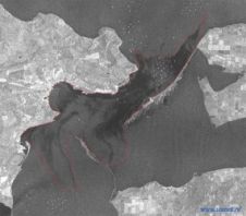
ScanEx Center (Russia) has received and processed Radarsat-1 satellite imagery of the wreck site in the Kerch Strait where on 11th November stormy wind (up to 32 m/sec) and sea...
In March 2007, R&D Center ScanEx signed a reseller agreement with INFOTERRA GmbH (incorporated into EADS Astrium GmbH) for the distribution of TerraSAR-X radar data and its end-products. In the...
EarthData International (EarthData) (MD, USA) has been awarded a US$4.3 million contract from the National Geospatial-Intelligence Agency (NGA) to map portions of one of South America’s largest countries using the...
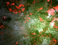
Copernicus Sentinel-1 radar data along with interferometric processing can map crop types from space even more effectively than the traditional method using optical satellite images, according to a recent study....
A coalition of ten major palm oil producers and buyers are collaborating to support and fund the development of a new, publicly available radar-based forest monitoring system known as Radar...
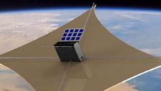
Researchers from SRI International have successfully demonstrated Interferometric Synthetic Aperture Radar (InSAR) capabilities with a radar developed for CubeSat-based earth science applications. Designed for the power and thermal requirements of...
This site uses cookies. By continuing to use this website, you agree to our Cookies Policy. Agree