Mapping from Satellite Imagery
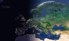
The emergence of new, low-cost, internet-based mapping tools like Google Earth, Google Maps, and NASA World Wind that make thousands of satellite images available to a wide audience has greatly...
The emergence of new, low-cost, internet-based mapping tools like Google Earth, Google Maps, and NASA World Wind that make thousands of satellite images available to a wide audience has greatly...
Remote sensing projects often begin with the question: 'Should I use aerial imagery or satellite imagery?'. During long-term projects, this question may arise again, particularly when unforeseen circumstances change the...

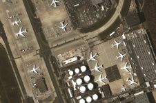
SI Imaging Services (SIIS) has expanded its array through a new partnership agreement with satellite imaging platform company SkyFi which gives SkyFi access to SIIS’s VHR Korean Multi-Purpose Satellite (KOMPSAT)...
EuroGeographics is drawing attention to the indispensable role of official national geospatial data in enhancing Copernicus Services, particularly within land monitoring and emergency management. This highlights a reinforced partnership between...
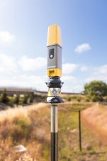
Topcon Positioning Systems has presented the latest addition to its HiPer family of global navigation satellite system (GNSS) receivers. The HiPer CR is a compact and lightweight GNSS receiver designed...

Mosaic has partnered with Movella aimed at redefining precision and efficiency in mapping and 3D reconstruction projects. Mosaic is specialized in mobile mapping camera systems, while Movella is a renowned...

Visitor registration is now open for GEO Business, the UK's largest geospatial event. The free-to-attend expo, tailored for geospatial professionals seeking to harness the potential of location intelligence, will return...
Airbus and Japanese geospatial solutions provider PASCO have signed a new partnership agreement for a Pléiades Neo Direct Receiving Station (DRS) with associated data distribution rights on the Japanese market....

A satellite map of the Israeli disaster area was used by Emercom of Russia during their assistance in fire-fighting activities near Haifa city. Detailed imagery of IKONOS satellite from 4th...
Navteq (IL, USA) has launched Digital Terrain Model and Satellite Imagery which enable richer, more realistic map display in location-based and navigation applications. These are in addition to NAVTEQ's 2D...
This site uses cookies. By continuing to use this website, you agree to our Cookies Policy. Agree