A Unique Constellation of Optical Satellites from Europe
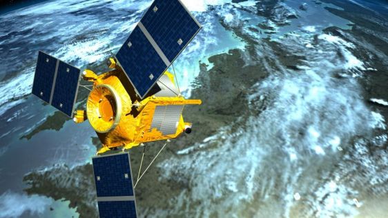
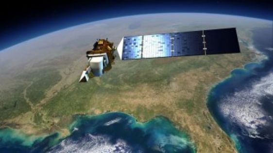
The launch of SPOT 7 on 30 June 2014 at 6:22 a.m. CET completed the constellation of four optical spacecraft operating in the same orbit. The constellation further consists of twin...
 The theme for May 2016 is Satellite Imagery. We picked out 10 articles, with topics ranging from satellite radar interferometry to measuring spatial developments. Several Earth Observation satellite constellations are highlighted, including the SPOT family and the Sentinel programme. In addition, various exciting applications of satellite imagery – for example the support of polio eradication and tracking urban change and flood risk – are covered.
The launch of SPOT 7 on 30 June 2014 at 6:22 a.m. CET completed the constellation of four optical spacecraft operating in the same orbit. The constellation further consists of twin...

Some years back I wrote in this column, “Today, Earth observation (EO) satellites are being constructed and launched at conveyor-belt speed.” This avowal was confirmed...
Easy access to repositories of space-borne imagery and other geospatial data is becoming increasingly important now that sensors are able to produce petabytes of data in the blink...
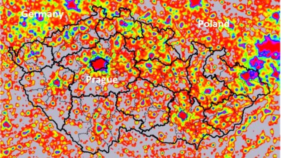
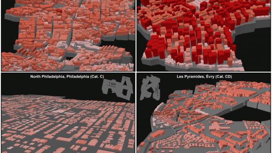
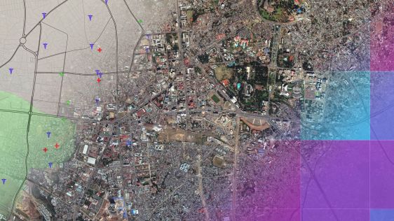
A country’s local spatial development can be derived from socio-economic indicators assigned to administrative units. Proper management and monitoring often require statistic...
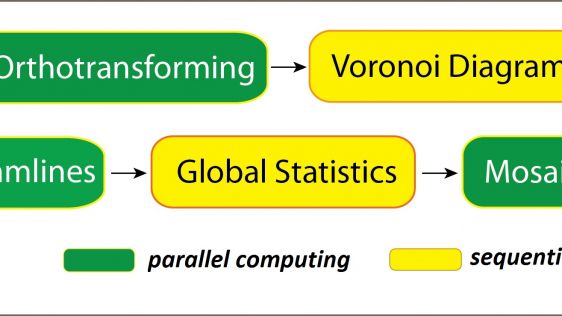
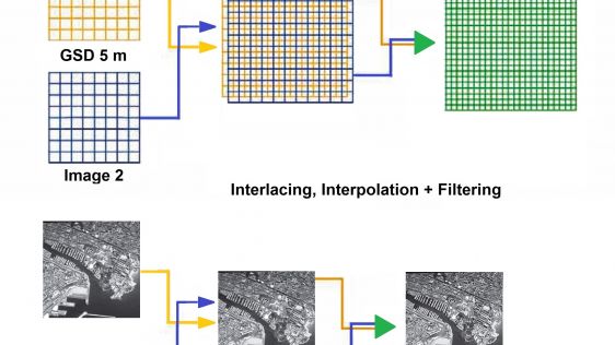
The race between data production and processing capacity has been going on for many decades, with data production usually on the winning team. This is also true for airborne and sp...
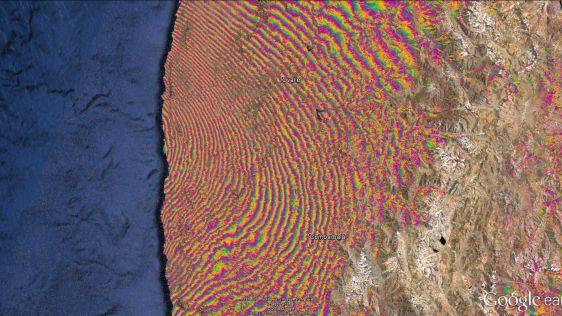
Despite first being published a couple of years ago, this article on InSAR is still topical, accurate and extremely relevant in the context of aerial mapping and Earth observation....
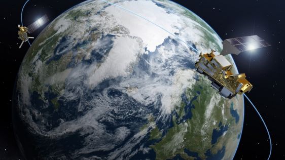
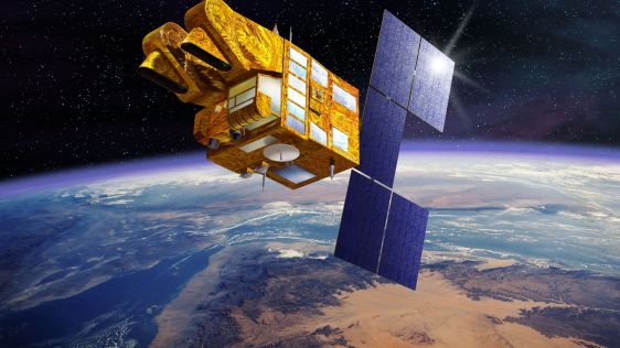
The launch of Sentinel-2A in June 2015 signalled the start of the era of the Sentinel-2 twin constellation. The satellite has been constructed by Airbus Defence and Space for the E...
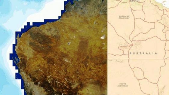
Since the SPOT 1 launch 30 years ago, SPOT satellites have covered the land area of the Earth more than 700 times, setting a world record for spatial observation. The pioneeri...
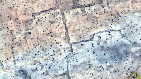
In September 2015, the World Health Organization announced that there had been no cases of wild poliovirus in Nigeria since 24 July 2014 and a full 12 months had subsequently passe...
When it comes to helping communities across the United States stay up to date on their flood risk, the Landsat satellite can take a bow. Landsat images help to track urban change,...
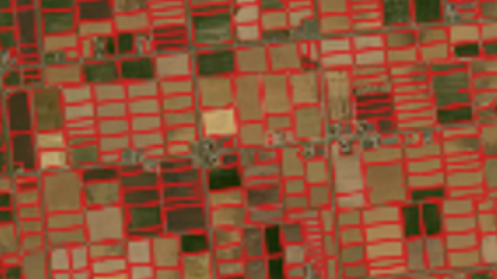
Remote sensing projects often begin with the question: 'Should I use aerial imagery or satellite imagery?'. During long-term projects, this question may arise again, particularly w...
The possibilities of geoAI for monitoring Mother Nature are limitless according to Dr Nadina Galle, an ecological engineer and entrepreneur dedicated to applying emerging technolog...
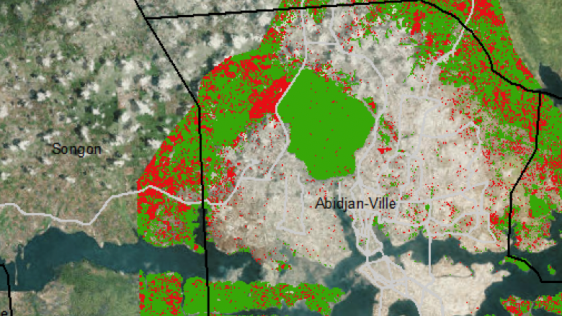
Combining big data with satellite imagery can help cities such as Kampala, the capital of Uganda, to better prepare for natural disasters such as urban flooding and make more infor...
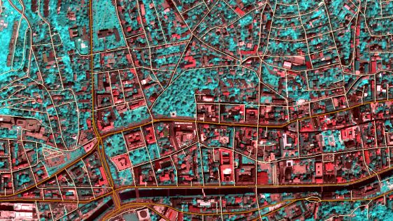
Hannes Taubenböck and his team at the German Aerospace Center (DLR) are using very high-resolution (VHR) satellite imagery, supplied by European Space Imaging, combined with a...
Over the past decade, Geosud has contributed to successfully mitigating the various obstacles to the operational use of satellite imagery for environmental management and territori...
This year marks 50 years since man first set foot on the moon. The Apollo-11 spaceflight landed on the moon on 20 July 1969, and just a few hours later Neil Armstrong and Buzz Aldr...
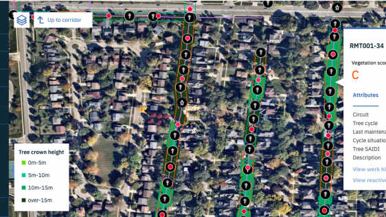
Airbus now provides very high-resolution satellite imagery to The Weather Company, an IBM Business, to help utility and energy companies better understand the state of vegetation n...
Earth observation company 4 Earth Intelligence (4EI) has launched a suite of data layers providing insight into a country’s wealth, demographics and transportation links. Der...
As part of their collaborative partnership to develop a national satellite data platform system for Indonesia, science education company PASCO and Indonesia’s National Space...

International aquatic remote sensing company EOMAP recently showcased its unique contribution to the world's first 3D habitat map of the Great Barrier Reef (GBR) at the Internation...
TCarta, a global provider of geospatial solutions, has teamed up with King's College London to win funding from the European Space Agency (ESA) to develop an air-quality modelling...
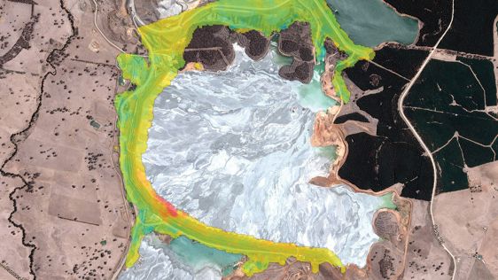
NPA Satellite Mapping, part of CGG’s Geoscience Division, has launched MineScope, a suite of satellite-derived services that enable mining companies and third-party consultan...
Follow GIM International on Facebook, LinkedIn, Twitter or sign up for the newsletter! Don't miss the latest developments: join GIM International!
 |  |  |  |
| 29.769 SUBSCRIBERS | 22.513 MEMBERS | 9.484 LIKES | 8.739 FOLLOWERS |
This site uses cookies. By continuing to use this website, you agree to our Cookies Policy. Agree