
LiMobile M1
The LiMobile M1 mobile laser scanning(MLS) system is equipped with a 45-degree titled LiDAR, a high-resolution camera, and a Ladybug5+ panoramic camera, which c...


GreenValley International Inc (GVI), headquartered in Berkeley, California, is a leading innovator of 3D mapping technologies. GVI provides a wide range of advanced aerial, terrestrial, and mobile LiDAR survey and mapping hardware systems and cutting-edge software as well as turnkey solutions. Our portfolio includes airborne, handheld, mobile, and backpack laser scanning platforms, as well as point cloud processing software such as the LiDAR360 LiDAR data processing platform. GVI focuses on LiDAR and image fusion technology, specializing in LiDar, UAV, SLAM, Photogrammetry, and other technologies to achieve an accurate digital representation of three-dimensional space. To date, our solutions have been adopted by users in over 130 countries, including the United States, Australia, Europe, Japan, and Singapore. As we continue to expand our reach and technological capabilities, GVI remains committed to driving innovation and pushing the boundaries of what's possible in the LiDAR space.

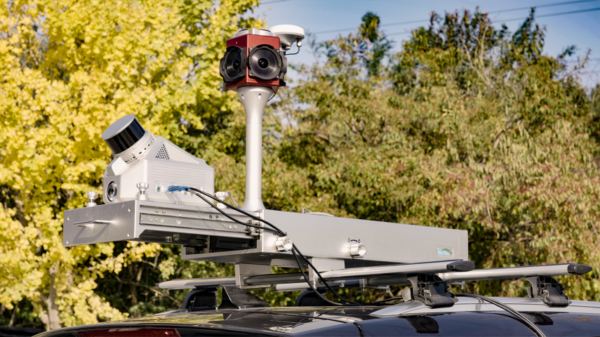
The LiMobile M1 mobile laser scanning(MLS) system is equipped with a 45-degree titled LiDAR, a high-resolution camera, and a Ladybug5+ panoramic camera, which c...

The LiAir X3C-H is a new compact high-performance UAV LiDAR system and is the upgraded version of the LiAir300 by GreenValley International. It adopts a new int...

LiAir X3-H is the newest compact, high-performance unit in the LiAir series by GreenValley International. It adopts a new integrated design style and integrates...

LiEagle is an aerial Lidar surveying system designed for large-area and long-range 3D data collection projects. The system is designed to be mounted to a helico...

LiHawk is an aerial Lidar surveying system designed for large-area and long-range 3D data collection projects. The system is designed to be mounted to a fixed-w...

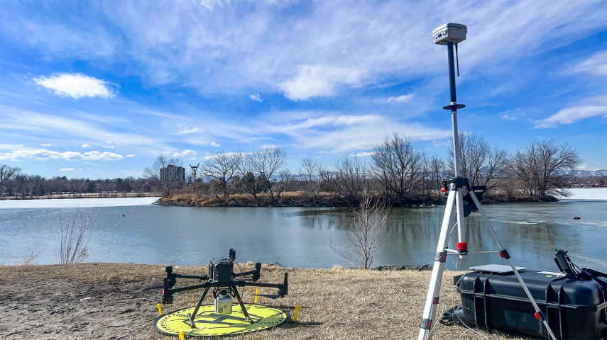
LiBase by GreenValley International. Featuring 965 channels, full RTK rover/base capabilities, 60-degree tilt compensation and centimetre-level accuracy. The mo...

Durable Design, Multi-Platform, Customizable, lightweight and compact. Available now!

LiBackpack DGC50 Lidar scanning system is the multi-sensor integrated version of the LiBackpack series, including a horizontal and vertical Lidar sensor, a high...

LiPod Lite by GreenValley international makes terrestrial 3D laser scanning (TLS) easier and more affordable than ever before. Its compact and lightweight desig...

The LiMobile can be used to acquire high-quality ground and terrain data on both sides of the road as it is equipped with a high-resolution camera. The system i...

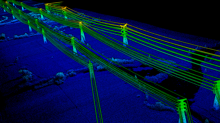
LiPowerline offers a complete and intuitive solution for power line inspection from LiDAR point clouds.

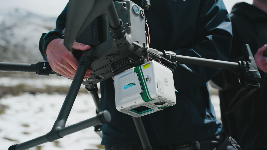
This lightweight 3D surveying and mapping payload was designed with DJI’s Matrice 600 Pro & DJI M300 RTK series platforms. The LiAir 220 is our UAV-mounted syst...

LiAir 50 N, powered by Velodyne‘s Puck sensor, is GreenValley's most cost-effective UAV LiDAR system. The LiAir 50 N is an ideal entry-level system or environm...

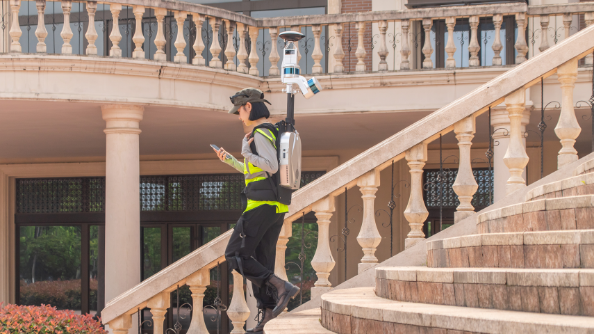
LiBackpack C50 is an advanced SLAM-based 3D mapping system which integrates LiDAR and 360° imaging technologies to produce true color point clouds.

LiAir 250 can generate up to 5 data points per laser pulse from its Riegl miniVUX-1 sensor. That, plus its 250 meter range, make it a well-qualified choice for...
LiBackpack DGC50 Lidar scanning system is the multi-sensor integrated version of the LiBackpack series, including a horizontal and vertical Lidar sensor, a high...

The LiAir V70 is a lightweight UAV- or sUAS-mounted LiDAR survey instrument designed and produced by GreenValley International (GVI). With its high flexibility...

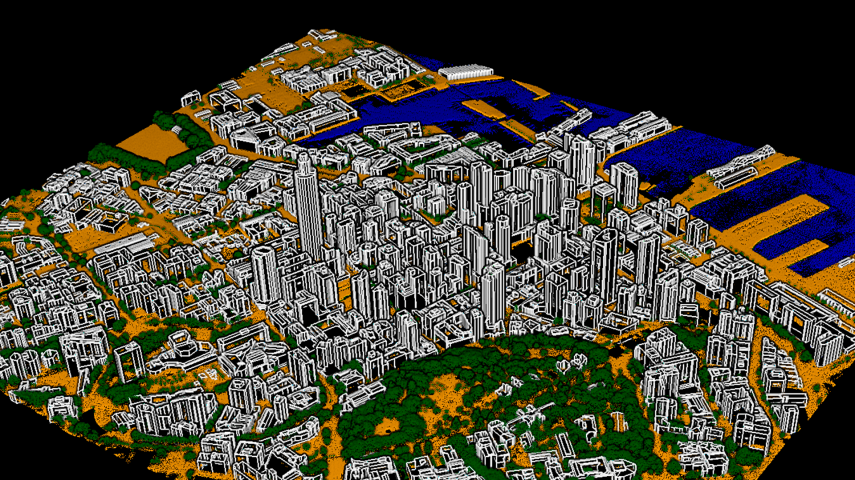
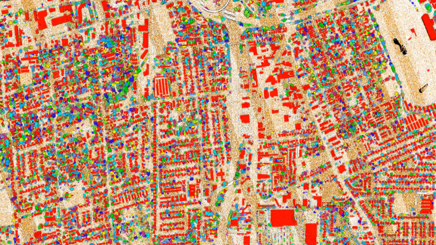
LiDAR360 is a comprehensive point cloud post-processing software that includes a variety of toolsets to efficiently visualize, manipulate and generate meaningfu...
This site uses cookies. By continuing to use this website, you agree to our Cookies Policy. Agree