Topcon’s SmoothRide Keeps German Road Resurfacing Project on Track
When construction company Matthäi was hired to resurface the busy B420 road around Fürfeld...


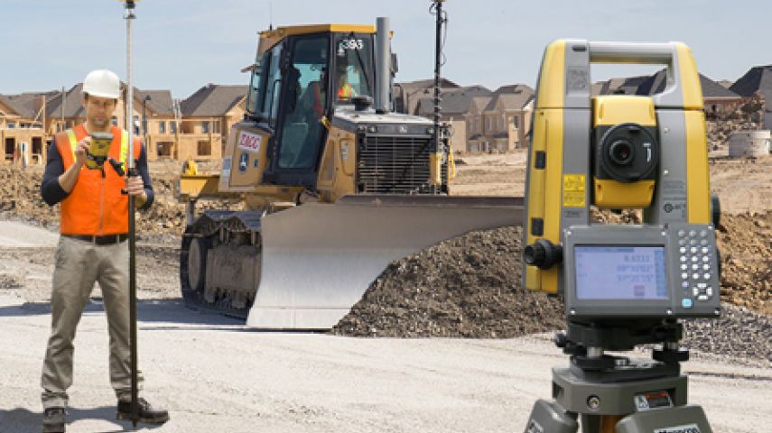
Topcon Positioning Group designs, manufactures and distributes precision measurement and workflow solutions for the global construction, geospatial and agriculture markets. Since it was founded in 1994, Topcon has worked to provide cutting-edge technology across these sectors, helping to enhance accuracy, efficiency and productivity.
Topcon provides a wide range of solutions across these industries, from its precise GT-1200 and GT-600 robotic total stations, to its state-of-the-art workflow management software, MAGNET.
Headquartered in Livermore, California, the company operates throughout North America, Europe, the Middle East and Africa, and has just opened a new European distribution centre in Zoetermeer, the Netherlands.
The company also owns a variety of product families operating across these regions, including Sokkia, Tierra, Digi-Star, RDS Technology, and NORAC, alongside a worldwide network of trusted distribution partners.
Across the globe, Topcon offers a comprehensive range of leading technologies and customer support, always striving to provide the right solution for every project.


When construction company Matthäi was hired to resurface the busy B420 road around Fürfeld...

Topcon Positioning Group has announced an expansion of the Topnet Live Global Navigation Satellite S...

Topcon Positioning Group has launched its Magnet 7 suite of software for construction and survey pro...

Topcon Positioning Group has entered into a new partnership with CyArk to ensure that culturally sig...

Built for job site mobility, the flagship GT Series ultrasonic robotic total station enables accurate and productive workflows for highly demanding survey and c...

A customized software application specifically for quick and confident design layout

• Fully automated system with GNSS and Sonic Tracker control • Delivers accurate thickness boundaries while maintaining projected yield • Eliminates the need...
This site uses cookies. By continuing to use this website, you agree to our Cookies Policy. Agree