ScanMaster 2.0
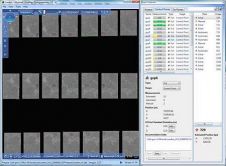
Topcon has announced the release of ScanMaster 2.0 software which is faster and more powerful than previous versions. This new software saves time and increases the productivity on every job,...
Topcon has announced the release of ScanMaster 2.0 software which is faster and more powerful than previous versions. This new software saves time and increases the productivity on every job,...
Navigation is a daily activity for many as they move from place to place. With increasing complexity in transportation networks has come a rising demand for navigational assistance. Over the...
We all know about the rapid evolution in world mapping. While mapping was long the domain of skilled mapmakers, nowadays it is increasingly in the hands of the lay public,...

Jonathan Arthur Quaye-Ballard is a professor and head of the Department of Geomatic Engineering at KNUST, where he has worked for the past 20 years. He also holds a BSc...

Incorporating smart methodologies in cadastral surveying is improving the land acquisition system in Ghana. Traditional cadastral surveying is time-consuming and, if not planned out well, could cost a fortune to...
Vexcel Imaging GmbH will roll out release 2.0 of its UltraMap photogrammetric software to customers beginning 25th January 2010. UltraMap 2.0 continues the tradition of providing a flexible and scalable...
Pitney Bowes Business Insight (PBBI) has unveiled Stratus Connect 2.0 during GeoCommunity 2009. The new features included in Stratus Connect 2.0 extend the capabilities of the definitive location intelligence tool...
Where2.0Now? is a one-day conference on 10th November 2009, hosted by the Association for Geographic Information (AGI) Northern Group (#AGI_NG) in partnership with the Centre for Spatial Analysis and Policy...
This site uses cookies. By continuing to use this website, you agree to our Cookies Policy. Agree