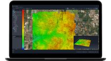
Lidar in surveying & mapping
Lidar, short for Light Detection and Ranging surveying, represents a sophisticated measuring system leveraging the power of light. Widely recognized for its versatility, Lidar is extensively applied in diverse fields...
Lidar, short for Light Detection and Ranging surveying, represents a sophisticated measuring system leveraging the power of light. Widely recognized for its versatility, Lidar is extensively applied in diverse fields...
Infoterra France and their Greek partner GEOMET Ltd have won a major contract, worth over €2.86 million, to deliver a significant quantity of fully orthorectified imagery and Digital Surface Models...

Linda Foster oversees Esri’s worldwide strategic vision for land administration and surveying. With 20 years of experience working in the land and resource industry, she is a registered professional land...

There are indications that today’s technological advances are putting a fully operational multipurpose cadastre within reach, following decades of a global vision and small-scale progress towards a comprehensive map-centric land...

Intermap has won a US$20 million contract to map the Indonesian island of Sulawesi this year. The contract is the first phase of the Indonesian national topographic basemap programme to...
SimActive has unveiled the enhancement of Correlator3D for improved cloud environment productivity. With Correlator3D’s distributed processing capabilities, clients can seamlessly scale their processing in line with operational needs. The challenges...
This site uses cookies. By continuing to use this website, you agree to our Cookies Policy. Agree