Found 309 results
Sort by

How to Use Mobile Mapping for CAD & BIM As-built Documentation

There is a general acknowledgement in the scanning and mapping industry that, compared to terrestrial laser scanners (TLS), mobile mapping systems significantly increase scanning speed and point cloud coverage. This is especially true for building interiors and equipment. This results in reduced time on site, which in turn lowers the cost of scanning for the service provider. There is a general acknowledgement in the scanning and mapping industry that, compared to terrestrial laser scanners (TLS), mobile mapping systems significantly increase scanning speed and point cloud coverage. This...

Read more

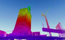
3D Modelling for Construction

When it comes to 3D modelling for construction, what are the advantages and disadvantages of photogrammetry versus Lidar in terms of accuracy, complexity and cost? Breaking away from laser measurement...

Read more

Q&A: The Quickly Evolving UAS Mapping Market

Drones have become a standard tool for mapping and surveying. Read what Gilles Labossière, CEO of senseFly, has to say about the market trends, technical developments and challenges affecting geospatial professionals. Even...

Read more

Richard Humphrey

Richard Humphrey is the vice president of construction product management at Bentley, focused on delivering construction solutions. He has more than 20 years of high-tech marketing and product management experience,...

Read more