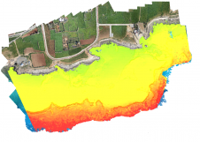
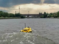
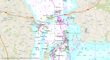
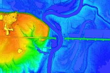
Found 161 results
Sort by

Panagiotis Agrafiotis

Panagiotis Agrafiotis holds a doctorate in Engineering from the National Technical University of Athens as well as an MSc in Geoinformatics and an MEng diploma in Surveying Engineering. His current...

Read more

Extraterrestrial hydrography

While there is still lots of ocean mapping work to do on Earth, oceans situated elsewhere in our solar system hold plenty of mysteries too, writes Wim van Wegen in...

Read more

Using the Apache Unmanned Survey Vessel

This paper explores the various features of the Apache USV series for efficient seafloor-level mapping. The CHCNAV hydrographic survey software is used for data recording and analysis. It provides results...

Read more

Positioning the World for the Future

FIG Commission 5 focuses on meeting the highest level of accuracy for Positioning and Measurement. It provides the tools, techniques and procedures to educate and train surveying professionals everywhere. Appropriate...

Read more