GPS for Land Subsidence Monitoring
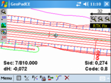
Excessive groundwater extraction in the Bandung Basin has led to rapid sinking of the water table and is hypothesised as the main cause of land subsidence. Periodical GPS surveys were...
Excessive groundwater extraction in the Bandung Basin has led to rapid sinking of the water table and is hypothesised as the main cause of land subsidence. Periodical GPS surveys were...
It is with great regret that ESA has announced the death of Michel Bignier, which occurred on 12 October. A leading figure in the space world, and a former director...
Rotterdam is Europe’s largest logistical and industrial hub and its port is the gateway to a European market of 450 million consumers. It is accessed by five competing modes: road,...
Geomatics technology can be used in many practical fields as a means of observation and analysis. One of these fields is forestry; a discipline approaching a golden age of information...
MapInfo Corporation (NY, USA) has acquired privately-held Graphical Data Capture, Ltd., (GDC), a London-based location intelligence provider and partner of MapInfo for the past 17 years. GDC develops applications and...
This is an exciting time for cartography. The volume of available geographic information continues to increase, from diverse sources and providers each with their own characteristics and quirks. One of...
SBG (Sweden) has released Stringline model software which produces a complete 3D model representing any type of road. It is an all new reference type that uses parallel stringlines. The...
Trimble Dimensions 2007 took place from 5th to 7th November 2007 at the Convention Center and Events Center, Mirage Hotel, Las Vegas, US. There were some 2,200 participants, up from...
With long experience in the production of navigational charts, nautical publications and electronic charts, today the Indian Naval Hydrographic Department (NHD) is well equipped to meet national and international requirements...
Microsoft Corporation has joined the Open Geospatial Consortium, Inc. as a principal member. Through its involvement with OGC, Microsoft is able to ensure the geospatial interoperability of its technology, including...
This site uses cookies. By continuing to use this website, you agree to our Cookies Policy. Agree