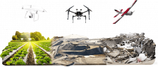
Visualization of Earth Observation Data
NASA Earthdata provides a number of ways to view imagery and create visualizations of data, whether you are interested in natural disasters, land surfaces, water resources or our oceans. Many of...
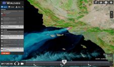
NASA Earthdata provides a number of ways to view imagery and create visualizations of data, whether you are interested in natural disasters, land surfaces, water resources or our oceans. Many of...
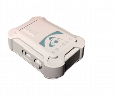
Eos Positioning Systems has released the Eos Bridge, which enables almost any instrument to become iOS Bluetooth compatible. Eos is the global manufacturer of Arrow Series GNSS receivers. The Eos Bridge...
The European Commission has entered into a contract with EOS Data Analytics, a satellite analytics company founded by Max Polyakov, to develop technologies for the monitoring and analysis of mining...
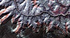
The major utilization of remote sensing data has been to compare images of an area taken at different times and identify the changes it underwent. With a wealth of long-term...
There are numerous software solutions available on the market for the photogrammetric processing of digital images and to generate 3D spatial data. Geoprofessionals can use the photogrammetric software to create...
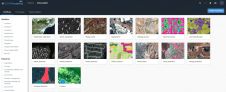
Most image analysis tasks that required ENVI or Erdas Imagine software are now available online thanks to EOS Platform, a new cloud service launched by Earth Observing System (EOS). It...
How can photogrammetric equipment and software developers provide the mapping and surveying community with solutions that are sophisticated, yet also meet high customer expectations in terms of user-friendliness? Photogrammetry is...

Copernicus, Europe’s most ambitious Earth observation (EO) programme to date, generates ten petabytes of free EO data every year for use by European governments, organisations and citizens. Big data from...

Francesco Nex is a professor in the Earth Observation Science (EOS) department at the University of Twente. His main research interests are focused on the development of innovative solutions fusing...

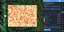
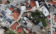
Monitoring crop growth provides timely and reliable spatial information to farmers and decision-makers employed in precision agriculture. The authors of this article tested the usability of UAS RGB images for...
This site uses cookies. By continuing to use this website, you agree to our Cookies Policy. Agree