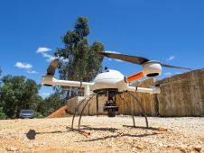
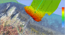
The mission: capturing 21 quarries in 60 days. Squeezed into that timeframe were planning and performing the UAV photogrammetry flights, editing the RAW images, processing the data, extracting the topography using Virtual Surveyor, and production of the orthophotos, Digital Surface Model (DSM), Digital Terrain Model (DTM) and contour maps for each site. The main client, a government institute, needed highly precise and reliable 3D models and maps fast, as well as data their engineers could work with in a CAD environment. “There was a lot of pressure because of the short timeline”, said Nuno Santos, owner and CEO of Aerisurvey, a Mangualde, Portugal-based company specialized in high-precision UAV surveying. Mapping 21 Quarries in 60 Days The mission was to capture 21 quarries in 60 days. Squeezed into that timeframe were planning and performing the UAV photogrammetry flights, editing the...