Found 4757 results
Sort by

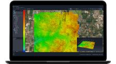
New Satellite Imagery Mapping Solution

DigitalGlobe (CO, USA) and DMTI Spatial Inc. (Canada) has announce the immediate availability of Satellite StreetView. Satellite StreetView is an imagery-mapping solution combining high-quality digital mapping data with the highest...

Read more

SimActive announces upgraded cloud capabilities

SimActive has unveiled the enhancement of Correlator3D for improved cloud environment productivity. With Correlator3D’s distributed processing capabilities, clients can seamlessly scale their processing in line with operational needs. The challenges...

Read more

Urs Hugentobler

Urs Hugentobler is a professor of Satellite Geodesy and heads the Satellite Geodesy Research Facility of the Technical University of Munich, which operates the Geodetic Observatory Wettzell together with the...

Read more