Found 149 results
Sort by

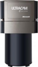
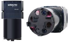
Microsoft UltraMap v3.9 Now Available

The recently announced updated version of the Microsoft UltraMap workflow software system is now available. UltraMap v3.9 enables UltraCam customers to produce richer data products, work more efficiently and cost-effectively,...

Read more

UAVs vs MAVs

James Eddy, technical director of Bluesky International and Industrial Associate at the University of Leicester explores the growing phenomena of Unmanned Aerial Vehicles in the UK and discusses the potential...

Read more

A Student's View on Intergeo

Just as in 2013, I once again visited Intergeo this year – held from 7-9 October in Berlin, Germany – to guide my students around the exhibition halls. Having all...

Read more

We Must Engage With Government

The UK needs to define the geospatial job category, says one of our European colleagues. He’s on the money there for sure and chartered surveyors need to be in the...

Read more

Who Should Own a Drone Company?

The big boys are buying new toys. Why they’re doing this is perceptively explained by our regular columnist Adena Schutzberg. Have you been keeping up with which of the big...

Read more