An interview is the ultimate opportunity to get to know key figures in the geomatics industry. The interview is a regular part of the GIM International magazine and is written to reveal the view of a professional, company or organisation regarding specific topic within geomatics. Topical questions will be answered by the interviewee concerning his company, organisation, products, market views, philosophies or strategies. Apart from the regular interview, the rubric ‘5 Questions to…’ is a short article and a quick way to introduce someone or something in the business.

Steven Ramage has spent most of his career in the geospatial sector working for Navteq (now HERE), 1Spatial, Open Geospatial Consortium, Ordnance Survey and what3words; with a short spell running Rama...

To gain a sound insight into what is going on in today's geospatial business landscape, 'GIM International' has asked some of the sector’s most influential companies for their opinions. This series...

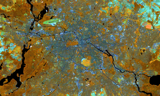
Digitalisation and new technologies with the ability to revolutionise the geospatial industry are creating a new playing field for mapping and surveying professionals. This evolving landscape is also ...

To gain real insight into today’s geospatial business landscape, 'GIM International' decided to ask some of the sector’s most influential companies for their opinions. This series of Q&As captures...

Niall Conway, editor of GIS Professional, spoke to Neil Brammall of Utility Information Services Ltd., a UK-based consultancy and services business which focuses on mapping buried utilities. In the fo...

Philipp Amon is Product Manager for RiCOPTER at RIEGL Laser Measurement Systems GmbH located in Horn, Austria. He graduated from a higher-level secondary college for industrial engineering and is cur...

A number of weeks ago, I made contact with a certain Perry Peterson, the founder of a Canadian-based company called PYXIS, in order to request an interview about the Open Geospatial Consortium’s n...

Ordnance Survey International (OSI) is a subsidiary of Ordnance Survey (OS), responsible for sharing the British mapping agency’s expertise and tradecraft with countries across the globe. In 2016, t...

CycloMedia is a renowned mapping company specialised in large-scale and systematic visualisations of environments. Its headquarters are situated in The Netherlands, a country that is an excellent test...

Suchith Anand served as the founding chair of the ICA Commission on Open Source Geospatial Technologies. He is currently serving as the chair of Geospatial IG of Research Data Alliance (RDA). He is wo...
This site uses cookies. By continuing to use this website, you agree to our Cookies Policy. Agree